
XGRIDS / STORIES & APPLICATIONS
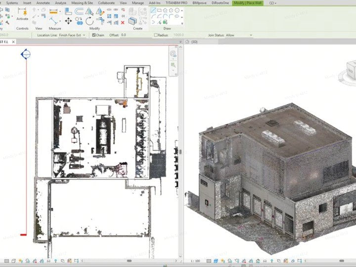
Carry a site capture into design and BIM
Design teams need current site conditions alongside drawings and models.
- Brand
- XGRIDS
- Article type
- Application guide
- Setting
- Architecture & construction
- Equipment
- Lixel scanners · LixelStudio · LCC
A workflow across a building’s life
XGRIDS’ AEC guide describes moving captured site conditions into survey, design, coordination, construction records and handover. It combines point-cloud processing in LixelStudio with visual spatial records associated with LCC workflows. This is an application guide, rather than one named customer’s measured result.
Give each deliverable a job
A measurement-oriented point cloud and a visual scene can serve different readers. DRT recommends identifying the person who needs each output: the designer checking geometry, the coordinator discussing an issue or the owner reviewing progress. Ask what they need to see and in which application they need to see it. This keeps the capture scope connected to a decision.
Agree on the handoff before capture
Prepare a sample file and have the receiving team open it in their actual software. Confirm units, orientation, reference information and how inaccessible areas will be recorded. Decide who checks alignment and who creates any downstream model. Capturing a space does not by itself define the scope or quality of a BIM model; those responsibilities should be written into the project plan.
Keep the record useful over time
For repeated visits, use clear dates and revision names, and preserve the raw dataset separately from edited outputs. Identify milestones worth documenting before conditions are covered or removed. A small pilot area can expose gaps in the process before an entire building is captured. The goal is a handoff that another project participant can use confidently, with the assumptions and limitations visible alongside the data.