
XGRIDS / STORIES & APPLICATIONS
Earthwork measurement on a construction site
Earthwork teams need a usable record of the site for volume measurement.
- Brand
- XGRIDS
- Article type
- Case highlight
- Setting
- Turkey
- Equipment
- XGRIDS Lixel L2 Pro
The published project brief
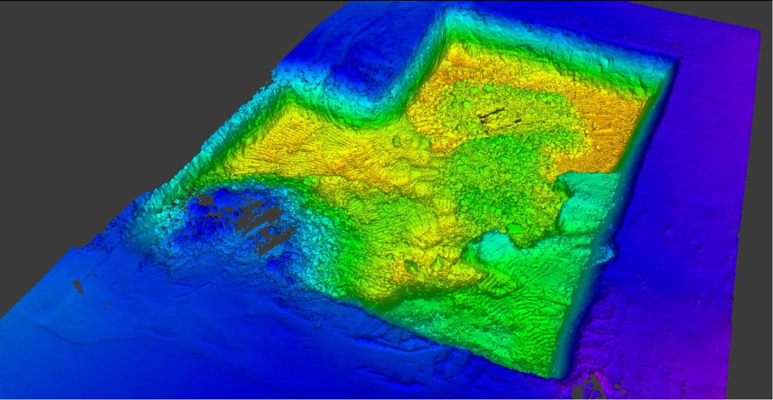
XGRIDS’ AEC case library highlights an Lixel L2 Pro capture of a 2,000m² construction site in Turkey for earthwork measurement. The example connects a recorded site surface with a volume-measurement task. The public case entry is a brief highlight rather than a full survey report.
What is not established by the brief
The entry does not provide the project’s complete control network, acceptance criteria or a verified before-and-after cost study. Those details should not be inferred from the scanner model or the size of the site.
Start with the measurement to be delivered
For a similar project, DRT recommends asking the receiving team to define the quantity being measured and the surface or boundary against which it will be compared. A useful scope distinguishes a progress record, a stockpile measurement and a contractual quantity assessment. The team should agree on the required accuracy, deliverable format and checking method before selecting the capture setup.
Preserve a traceable result
Keep the raw capture, processed dataset, selected boundaries and calculation settings together. Record the capture date and any inaccessible areas. If the site will be measured repeatedly, agree how each visit will relate to the same reference and how changes will be reviewed. A demonstration should carry a representative dataset through the receiving team’s measurement process. That establishes whether the proposed equipment and software can support the actual deliverable, while keeping the limits of the short manufacturer example clear.