

If you have any questions, you are always welcome to contact us. We'll get back to you as soon as possible, within 24 hours on weekdays.
-
Shipping Information
We offer reliable shipping across the United States. Orders over $599 qualify for free standard shipping.
Shipping options and estimated delivery times are shown at checkout and may vary by product and destination.
Products containing lithium-ion batteries may be subject to special shipping and carrier requirements.
For large equipment or enterprise orders, please contact our sales team for shipping assistance.
-
Customer Support
Need help choosing the right product, checking an order, or troubleshooting a product?
Our team can assist with product selection, order status, shipping, warranty, technical support, and general product questions.
Sales & Product Inquiries
Phone: +1 (888) 356-6818
Email: sales@droneroboticstec.comTechnical Support
+1 (888) 356-6818 Ext. 804 — Christopher
+1 (888) 356-6818 Ext. 806 — LucasWorking Hours
Mon–Fri: 9:00 AM–5:00 PM PST -
Contact Us
Have a question before placing an order?
Contact our sales team for product recommendations, availability, pricing, enterprise solutions, and bulk orders.
Sales Team
Phone: +1 (888) 356-6818
Email: sales@droneroboticstec.comFor enterprise, commercial, bulk, or dealer inquiries, we're happy to help you find the right solution.
V10L
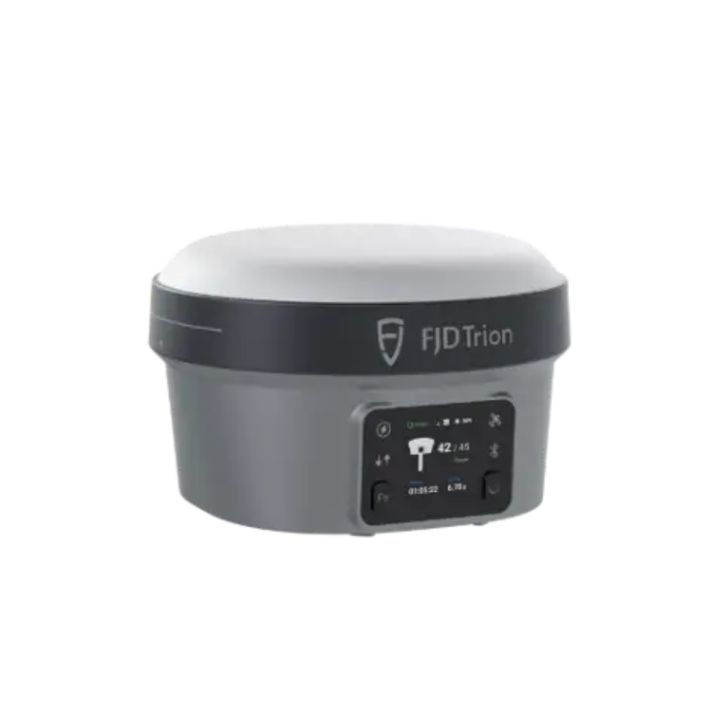
GNSS Receiver with Laser Measurement
FJD Trion V10L combines high-precision GNSS positioning with integrated laser measurement, enabling surveyors to aim, measure, and stake out points from a distance. Capture points without stepping into difficult or inaccessible areas and streamline field surveying with visual guidance and intelligent targeting.
Position. Measure. Stakeout.
V10L brings GNSS positioning, laser measurement, visual targeting, and field guidance together in one professional surveying system.
High-Precision GNSS
1408 GNSS channels and centimeter-level RTK positioning support precise point collection and professional surveying workflows.
Laser Measurement
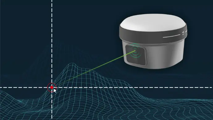
Measure points without direct contact using integrated laser measurement, with a range of up to 80 m.
Visual Stakeout
AR guidance shows direction and distance on screen, helping operators locate and stake out points efficiently.

Measure Without Stepping Into the Site
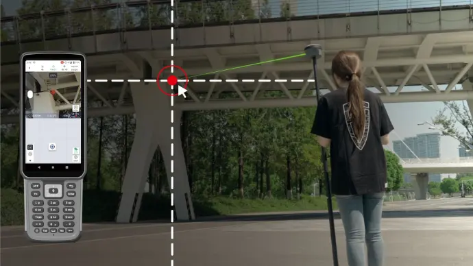
V10L allows surveyors to measure points from a distance without physically touching the target. Aim at the required point and capture the measurement directly from the field.
This can simplify measurements around walls, structures, roadsides, slopes, obstacles, and other locations where direct access is difficult.
- Measure points without direct contact
- Aim and capture from a distance
- On-screen measurement guidance
- Suitable for hard-to-reach targets
Laser Measurement Built for Field Surveying
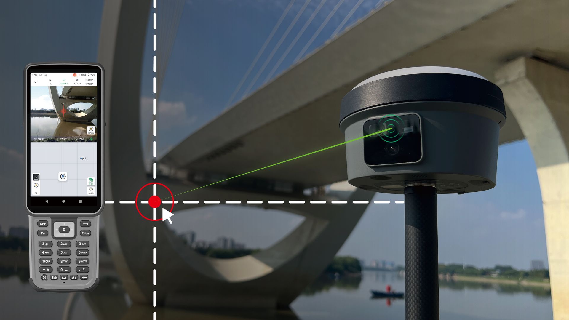
The integrated green laser provides long-distance targeting and measurement, while the camera system helps operators identify the desired point.
The V10L laser system supports measurements up to 80 m, providing a practical solution for non-contact field measurement.
- Laser Type: Class 2M Green
- Wavelength: 520 nm ±20 nm
- Measuring Range: 0–80 m
- Accuracy: ≤2 cm within 5 m
- Accuracy: ≤3 cm within 10 m
- Accuracy: ≤4 cm within 15 m
Find and Lock onto Targets Faster
Use the live camera view to identify the target before measurement. Automatic alignment and zoom make it easier to select precise points, including targets at longer distances.
- Live camera targeting
- Automatic alignment
- Zoom for precise point selection
- Faster target identification in the field
See Where to Stake Out Before You Walk There
V10L provides on-screen visual guidance to help operators understand the direction and distance to the stakeout point before moving across the site.
AR guidance can help reduce unnecessary walking and back-and-forth movement during field layout.
- On-screen direction guidance
- Distance information
- Visual stakeout workflow
- Reduced back-and-forth movement
Faster Setup with Calibration-Free IMU
V10L features a second-generation IMU designed for faster initialization and reliable positioning during field surveying.
With tilt compensation from 0° to 60°, operators can collect points without needing to keep the pole perfectly vertical.
Up to 60% faster startup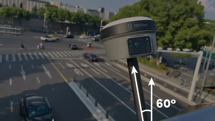
V10La or V10Li
Choose the configuration that matches your surveying workflow and measurement requirements.
FJD Trion V10La
Designed for standard point-by-point surveying with non-contact measurement and laser stakeout.
- Non-contact laser measurement
- Laser stakeout
- GNSS RTK positioning
- Visual targeting
FJD Trion V10Li
Adds visual measurement for selecting multiple points from a single image, making it suitable for projects with many targets or complex scenes.
- Everything in V10La
- Visual measurement
- Multiple points from a single image
- Designed for complex scenes and multiple targets
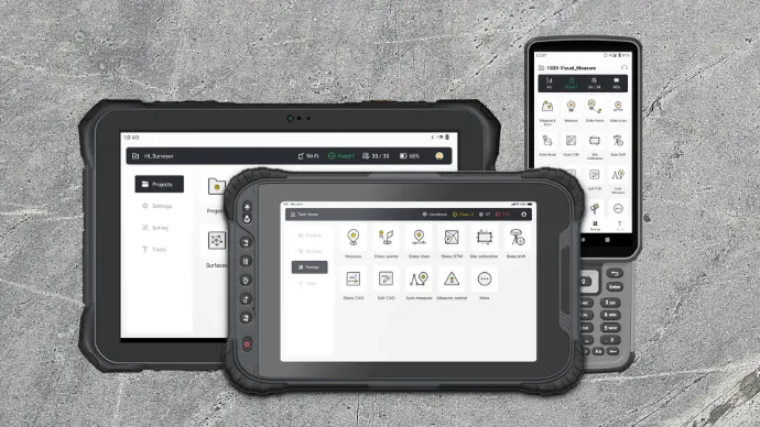
Field Control at Your Fingertips
V10L works with either a compact keyboard controller or a tablet controller. Powered by the Trion Survey app, operators can control surveying and non-contact measurement operations through a streamlined interface.
- Compact keyboard controller support
- Tablet controller support
- Trion Survey application
- Simple swipe and click operation
Built for Demanding Survey Workflows
Non-contact measurement and precise GNSS positioning help bring greater flexibility to a range of field surveying and measurement applications.
Land Surveying
Capture accurate points and measurements across varied terrain.
Construction
Support site measurement, positioning, and layout workflows.
Infrastructure
Measure structures and difficult-to-access points from a distance.
Power Inspection
Support measurement around substations and power infrastructure.
Topographic Survey
Collect positioning and elevation data for field mapping workflows.
Bridge Survey
Measure difficult points around bridges and elevated structures.
Underpass
Extend measurement capability into restricted or difficult areas.
Riverbank Survey
Measure points where direct access may be inconvenient or unsafe.
Forestry
Support field positioning and measurement across challenging outdoor environments.
Mapping
Combine GNSS positioning and measurement for professional field mapping.
FJD Trion V10L Technical Specifications
Key specifications for the V10L GNSS receiver and laser measurement system.
| Product | FJD Trion V10L |
| Product Type | GNSS Receiver with Laser Measurement |
| GNSS Channels | 1408 channels |
| RTK Accuracy | Horizontal: 8 mm + 1 ppm RMS Vertical: 15 mm + 1 ppm RMS |
| RTK Initialization | Less than 5 seconds |
| Initialization Reliability | Greater than 99.9% |
| PPK Accuracy | H: 3 mm + 1 ppm RMS V: 5 mm + 1 ppm RMS |
| Tilt Compensation | 0–60° |
| RTK Tilt-Compensated Accuracy | 8 mm + 0.6 mm/° RMS |
| Laser Type | Class 2M Green |
| Laser Wavelength | 520 nm ±20 nm |
| Laser Measuring Range | 0–80 m |
| Laser Measurement Accuracy | ≤2 cm within 5 m ≤3 cm within 10 m ≤4 cm within 15 m |
| Camera | Dual 2 MP |
| Camera Field of View | 88° |
| Network Modem | Integrated 4G modem |
| Wi-Fi | 2.4 & 5 GHz, 802.11a/b/g/n/ac |
| Built-in UHF Radio | 410–470 MHz / 902–928 MHz |
| UHF Range | Typical 6–12 km; up to 16 km under optimal conditions |
| Internal Storage | 32 GB |
| Battery | 7000 mAh, 7.4 V Li-ion |
| Charging | 30 W PD Fast Charge |
| Operating Time | Rover: 15 h Base: 10 h Static: >25 h |
| Operating Temperature | -35°C to 65°C |
| Ingress Protection | IP68 |
| Drop Resistance | Designed to survive a 2 m pole drop |
| Dimensions | Φ130 × 83 mm |
| Weight | Approximately 980 g |
| Display | 1.41-inch True Color OLED, 320 × 360, 274 ppi |