
If you have any questions, you are always welcome to contact us. We'll get back to you as soon as possible, within 24 hours on weekdays.
-
Shipping Information
We offer reliable shipping across the United States. Orders over $599 qualify for free standard shipping.
Shipping options and estimated delivery times are shown at checkout and may vary by product and destination.
Products containing lithium-ion batteries may be subject to special shipping and carrier requirements.
For large equipment or enterprise orders, please contact our sales team for shipping assistance.
-
Customer Support
Need help choosing the right product, checking an order, or troubleshooting a product?
Our team can assist with product selection, order status, shipping, warranty, technical support, and general product questions.
Sales & Product Inquiries
Phone: +1 (888) 356-6818
Email: sales@droneroboticstec.comTechnical Support
+1 (888) 356-6818 Ext. 804 — Christopher
+1 (888) 356-6818 Ext. 806 — LucasWorking Hours
Mon–Fri: 9:00 AM–5:00 PM PST -
Contact Us
Have a question before placing an order?
Contact our sales team for product recommendations, availability, pricing, enterprise solutions, and bulk orders.
Sales Team
Phone: +1 (888) 356-6818
Email: sales@droneroboticstec.comFor enterprise, commercial, bulk, or dealer inquiries, we're happy to help you find the right solution.
FJD Trion S1 3D LiDAR Scanner
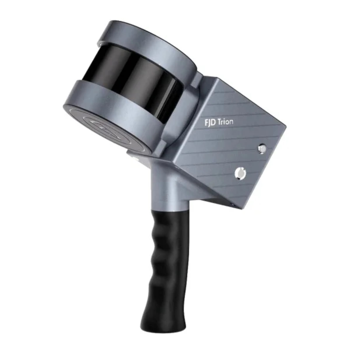
Capture indoor and outdoor environments with mobile 3D LiDAR scanning. The FJD Trion S1 combines LiDAR sensing and SLAM technology to generate real-time point clouds while you move through the environment.
A New Way to Scan the World
With an industry-leading SLAM algorithm, S1 and S1 Pro can quickly capture high-quality scans while
processing and displaying accurate point clouds on the mobile terminal in real time.
Scan More. Carry Less.

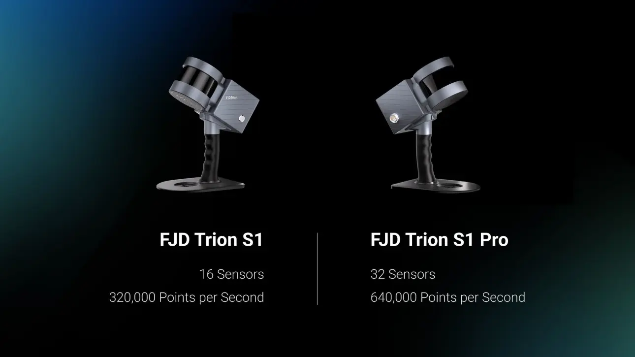
Elevate your scanning capabilities with FJD Trion S1 Pro, an advanced version of S1. Building upon the lightweight and portable design of S1, the S1 Pro delivers even greater accuracy and efficiency with its upgraded hardware.
Build Your Reality as You Scan
Powered by SLAM technology, the S1 continuously captures spatial information as you move through an environment. The system can generate a real-time point cloud, allowing operators to monitor coverage and visualize the scanned space during data collection.
Scan rooms, corridors, structures, tunnels, facilities, terrain, and other complex environments without setting up a traditional stationary scanner at every location.
Real-Time Point Cloud
Move through the environment and capture spatial data.
Monitor point-cloud coverage during scanning.
Process captured data into useful 3D deliverables.
Capture Large Spaces Efficiently
The S1 is designed for mobile scanning workflows where speed and portability matter. FJD reports that a 100 m² area can be scanned in approximately 2 minutes, helping reduce the time required for field data collection.
Points / Second
High point acquisition speed for detailed spatial capture.
Long-Range Scanning
Maximum range at 90% reflectivity under specified conditions.
100 m² Example
FJD's published example for scanning a 100 m² area.
Detailed 3D Spatial Capture
With a 360° × 270° field of view and 0.36° horizontal angular resolution, the S1 captures surrounding geometry across a broad range of environments.
| Specification | FJD Trion S1 |
|---|---|
| Maximum Range | 120 m @ 90% reflectivity |
| Range @ 10% Reflectivity | 80 m |
| Relative Accuracy | 2 cm* |
| Points Per Second | 320,000 |
| Field of View | 360° × 270° |
| Horizontal Angular Resolution | 0.36° |
| Vertical Angular Resolution | 2° |
*Relative accuracy is based on FJD Trion published specifications and testing conditions. Actual results may vary according to scanning environment and processing conditions.
Scan Where Traditional Equipment Cannot
The S1 scanner weighs approximately 1.8 kg and can be used in handheld, backpack, or shoulder-strap configurations. Its portable design makes it suitable for moving through indoor spaces, outdoor environments, underground areas, and other challenging locations.
One Scanner. Multiple Configurations.
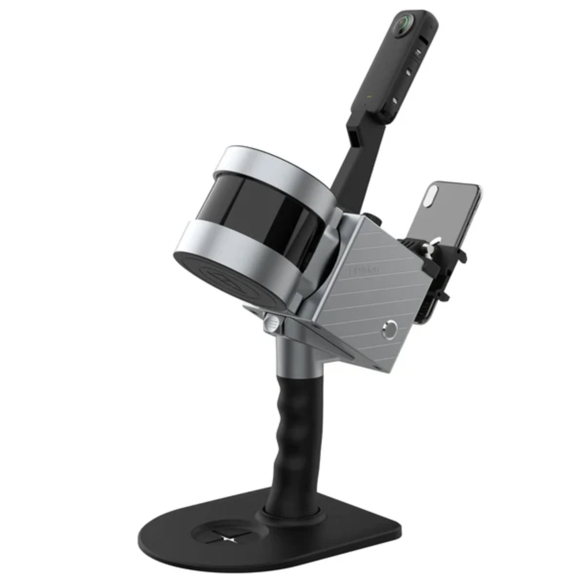
Adapt the S1 to different field environments with multiple mounting configurations. Select the setup that matches your scanning workflow.
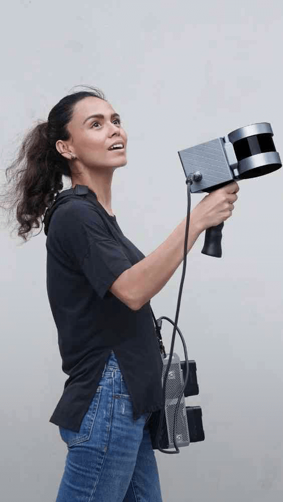
Handheld
Walk through indoor or outdoor environments while collecting mobile point-cloud data.
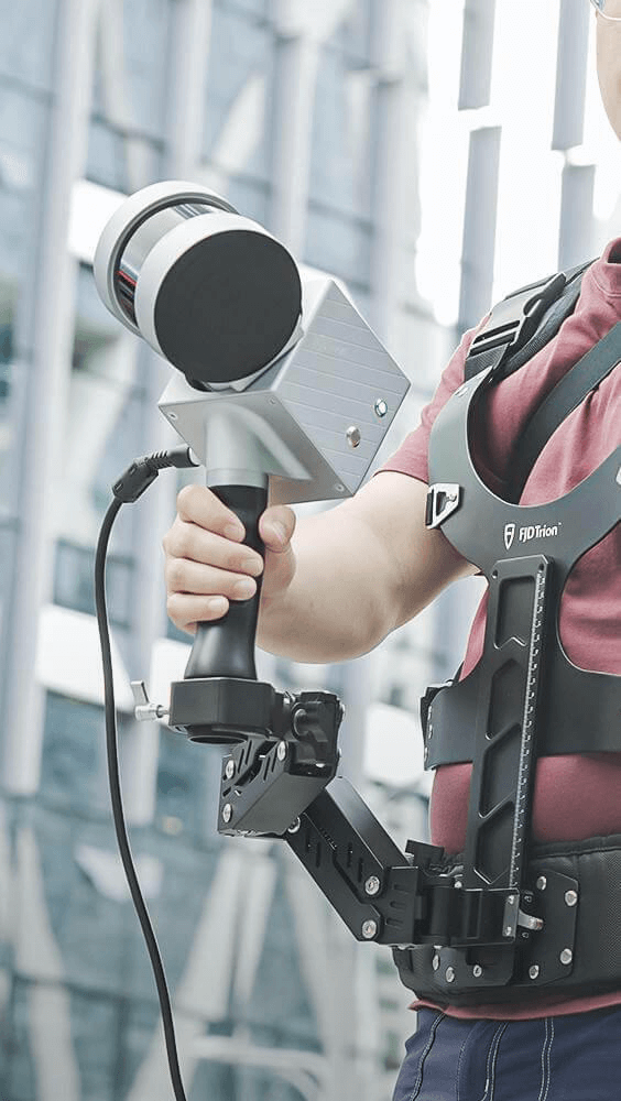
Backpack
Combine the scanner with the backpack configuration for mobile scanning over larger areas and outdoor projects.
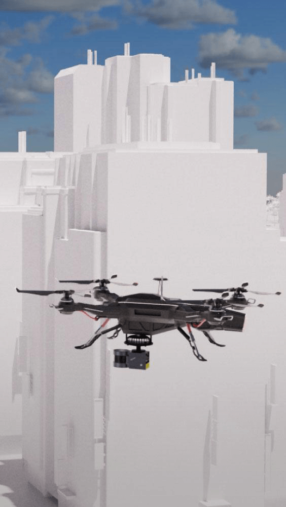
Drone Mount
Mount the scanner on a compatible drone platform for aerial scanning applications and difficult-to-access environments.
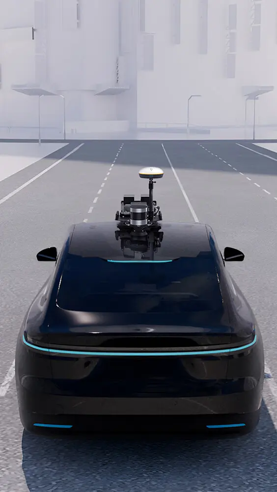
Car Mount
Collect mobile point-cloud data from a vehicle for roads, infrastructure, terrain, and larger outdoor environments.
Add RTK for Outdoor Mapping
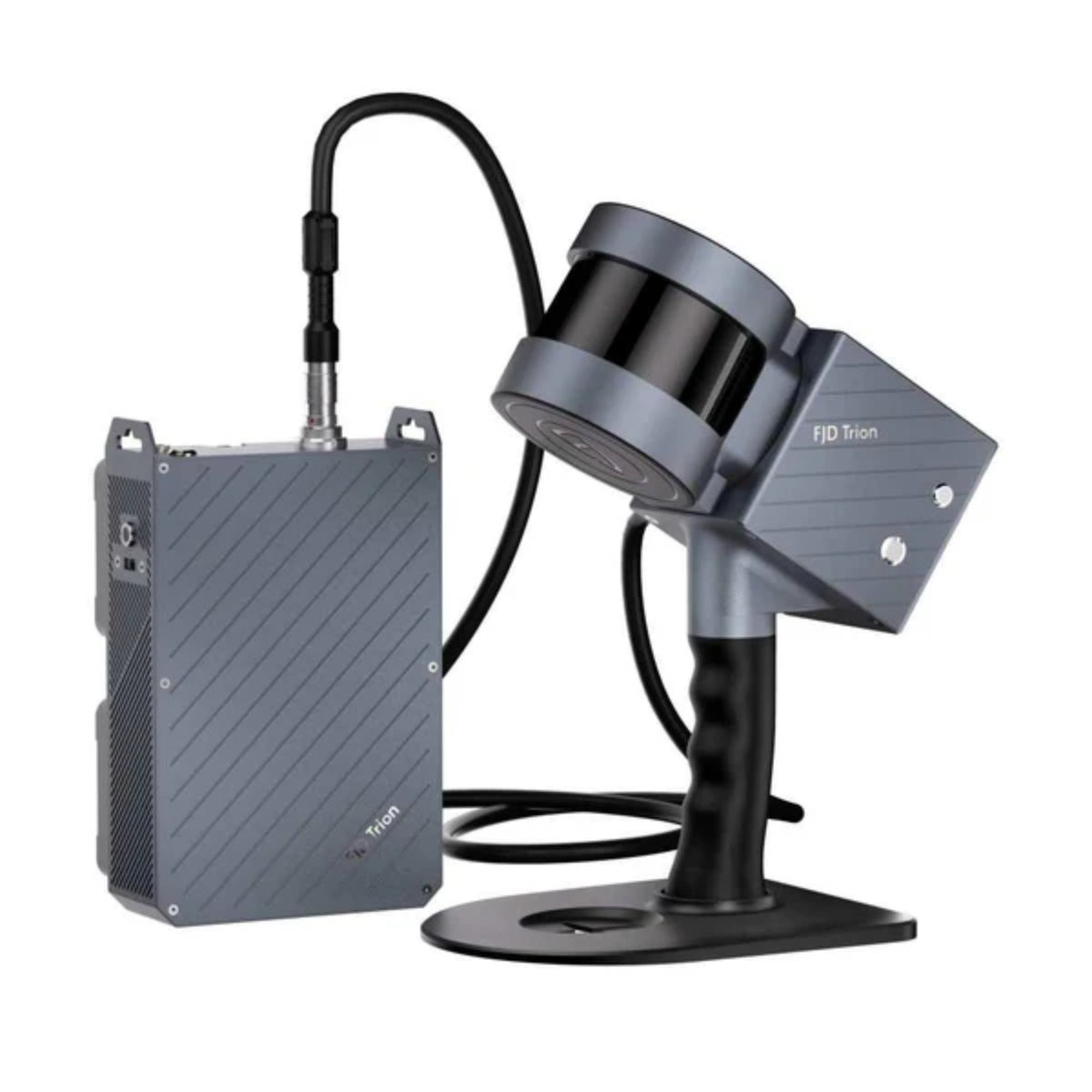
For outdoor mobile scanning, the S1 can be paired with the FJD Trion V1t RTK Rover and backpack configuration to generate geo-referenced point clouds with centimeter-level positioning.
S1 + V1t RTK Rover
A mobile scanning configuration designed for outdoor projects where spatial data needs to be tied to a geographic coordinate system.
Add RGB & Texture Information
An optional panoramic camera can add RGB and texture information to point clouds and meshes, helping create more visually rich 3D datasets and deliverables.
Capture panoramic visual information.
Add color information to spatial data.
Enhance point-cloud and mesh visualization.
From Scan to Deliverable
The S1 works with the FJD Trion software ecosystem to streamline the workflow from field data collection and point-cloud processing to preview, delivery, sharing, and collaboration.
FJD Trion Scan
Control scanning in the field, collect spatial data, and manage scan files.
FJD Trion Model
Process point-cloud data and generate project-specific models and reports.
On-Site Processing
Preview and process data on supported iPadOS and Android tablet workflows.
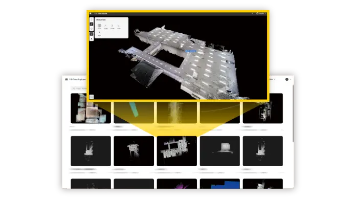
Trion Model Web
Share project results online and support collaboration across teams.
Built for Real-World 3D Mapping
From construction and infrastructure to forestry and mining, the S1 provides a flexible mobile scanning platform for three-dimensional data capture.
Construction & BIM
Capture existing conditions, interiors, structures, and site environments for 3D documentation and modeling.
Forestry
Collect spatial data across outdoor environments and forested areas.
Mining & Tunnels
Capture complex underground spaces and terrain for measurement and documentation.
Facility Digitalization
Digitize buildings, facilities, and complex interior environments into detailed 3D datasets.
Inspection & Mapping
Capture spatial information for inspection, mapping, and asset documentation workflows.
Public Safety
Rapidly capture environments where portable 3D mapping can support field operations.
Technical Specifications
| Specification | FJD Trion S1 | FJD Trion S1 Pro |
|---|---|---|
| Range | 120 m @ 90% reflectivity | 120 m @ 90% reflectivity |
| Field of View (FOV) | 360° × 270° | 360° × 270° |
| Points per Second | 320,000 | 640,000 |
| Display | Real-time preview on mobile terminal | Real-time preview on mobile terminal |
| Datalogger Weight (incl. single battery) | 2.2 kg | 2.2 kg |
| Battery Life (Dual Battery) | 4 hours | 4 hours |
| Ingress Protection | IP54 | IP54 |
| Sensors | 16 | 32 |
| Laser Class | Class 1 / λ 905 nm | Class 1 / λ 905 nm |
| Relative Accuracy | 2 cm* | 2 cm* |
| Processing | Real-time | Real-time |
| Carrier | Backpack or shoulder strap | Backpack or shoulder strap |
| Scanner Weight | 1.8 kg | 1.8 kg |
| Storage Capacity | 512 GB | 512 GB |
*FJD Trion specifies 2 cm relative accuracy based on its published testing conditions and post-processed reconstruction models. Actual accuracy may vary depending on the scanning environment, trajectory, surface properties, reconstruction method, and other factors.