


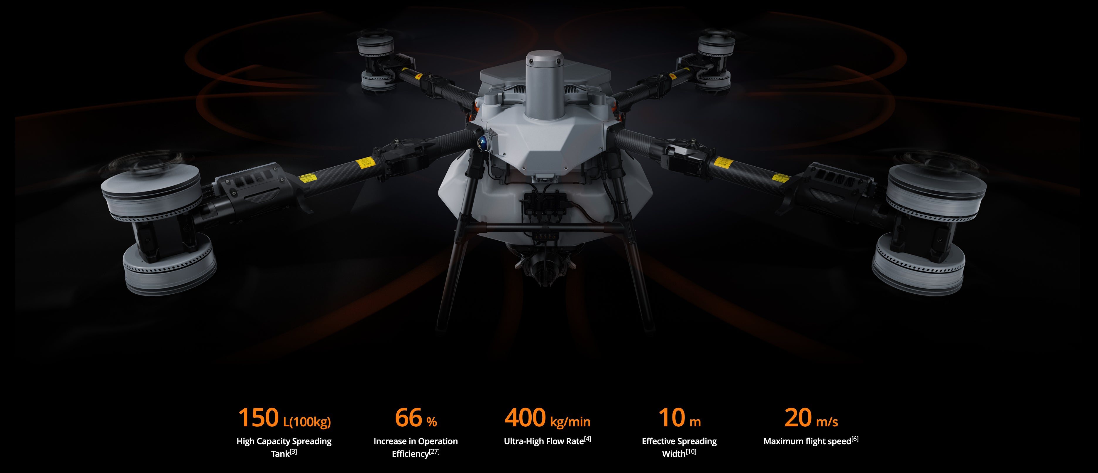
-
Water-Cooled Mist Sprinkler(Optional)
Fine droplets as small as 50 μm[23]penetrate canopies for comprehensive leaf coverage. A new liquid flow path helps dissipate dual centrifugal motor heat for durability and longevity.
-
Dual Atomization Centrifugal Sprinkler
New flow channel design, particle size range 50-500 μm[9], suitable for most operational scenarios.


-
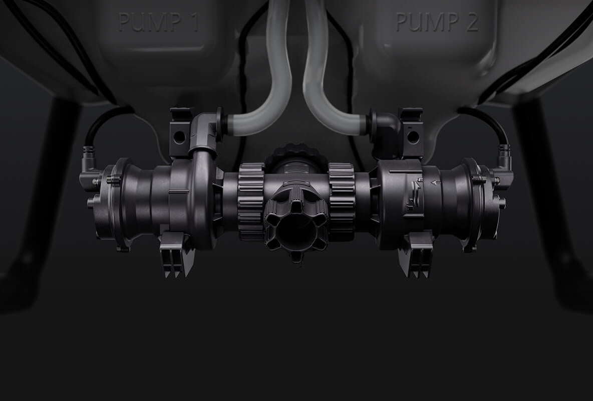
Magnetic Drive Impeller Pumps
Corrosion-resistant, stable, and reliable, an optimized impeller structure and increased chamber volume meet the high flow demands of orchard scenarios.
-
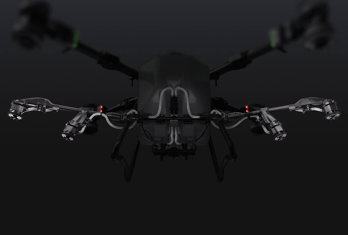
Rear Four Sprinklers Array
It expands the spray width for orchard operations while maintaining uniform coverage. It also minimizes visual interference from mist, enhancing operational reliability and precision.
-
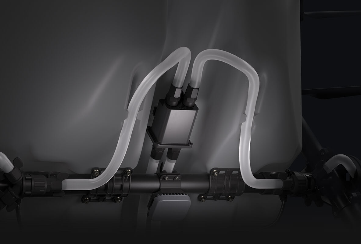
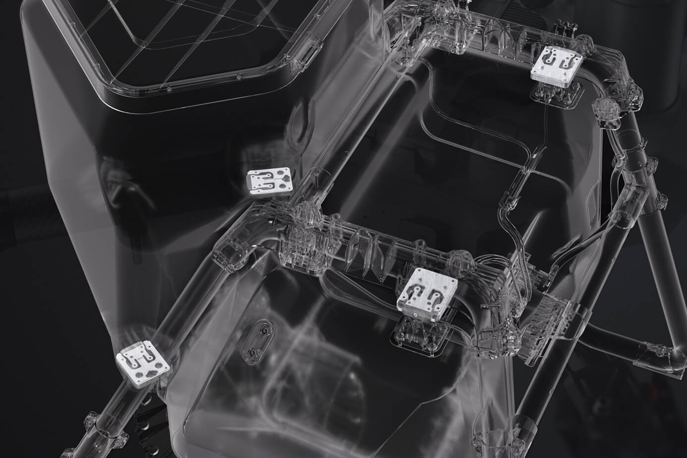
Dual-Channel Electromagnetic Flow Meter
Real-time precise flow detection and dynamic control ensures high-precision operations. It avoids direct contact with the liquid, preventing corrosion and enhancing durability.


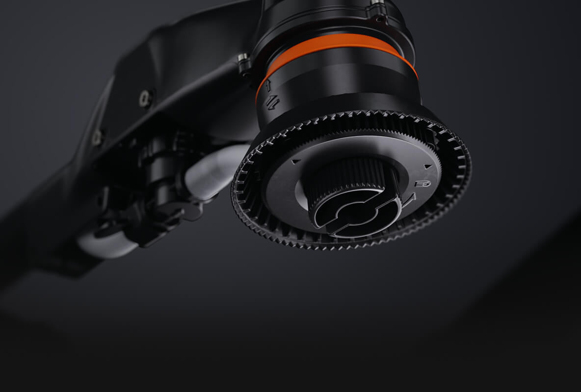
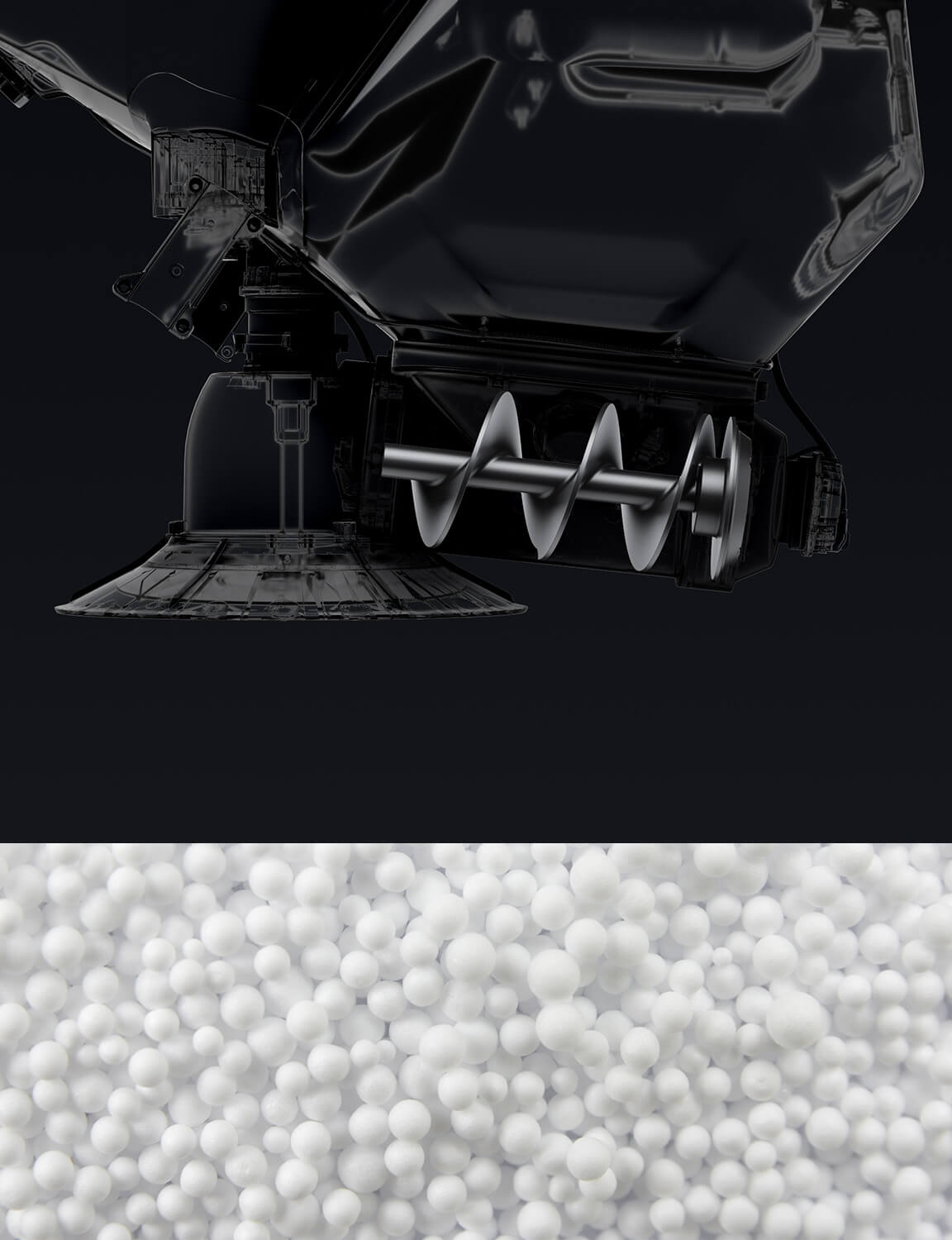
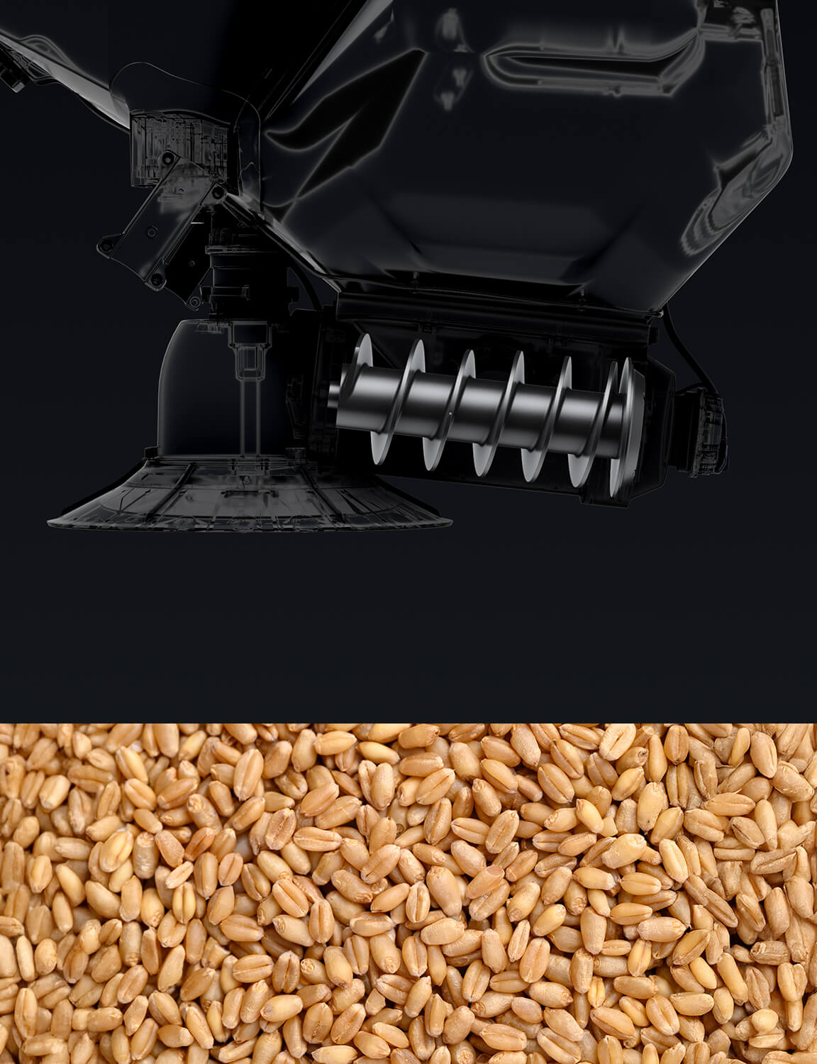
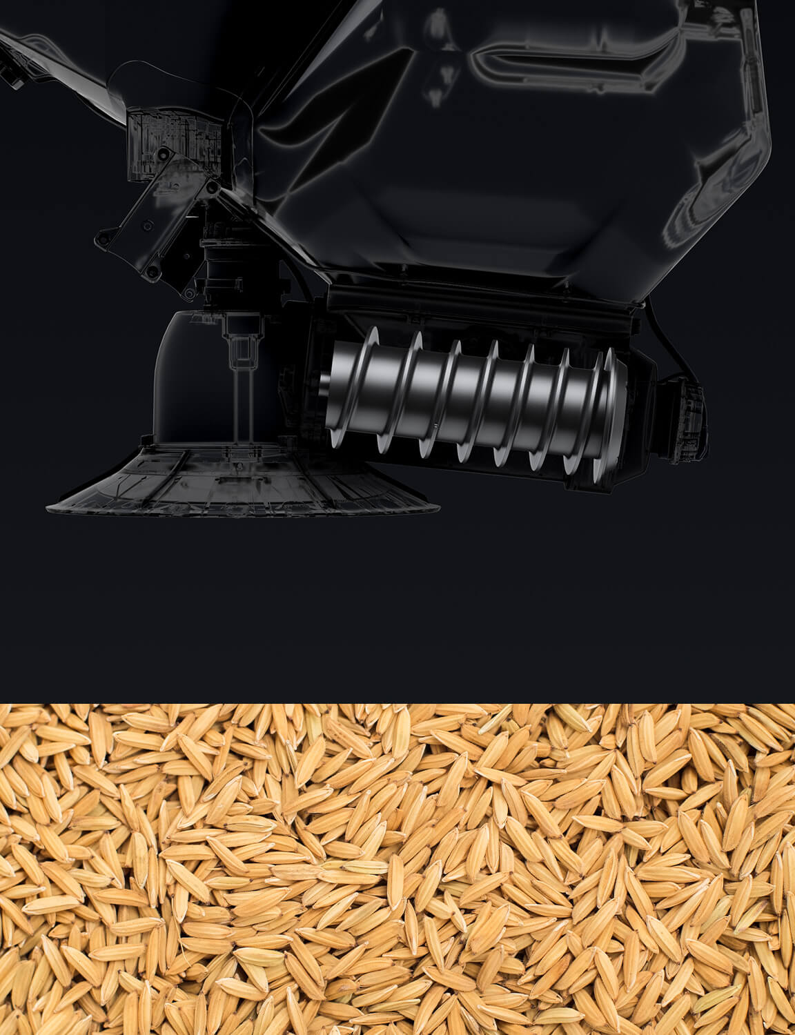
Brand-New Screw Feeder
Spreading accuracy doubled, flow rate increased by 270%[7], and granulars applicability further enhanced.
High-Precision Weighing Sensor
Provides real-time, accurate display of granular quantity, allowing for precise usage and refilling, effectively minimizing waste. Automatic flow rate calibration and cloud-save operation templates, making spreading operation more accurate and convenient.
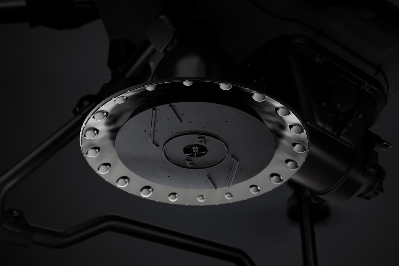
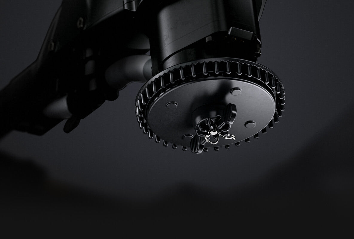
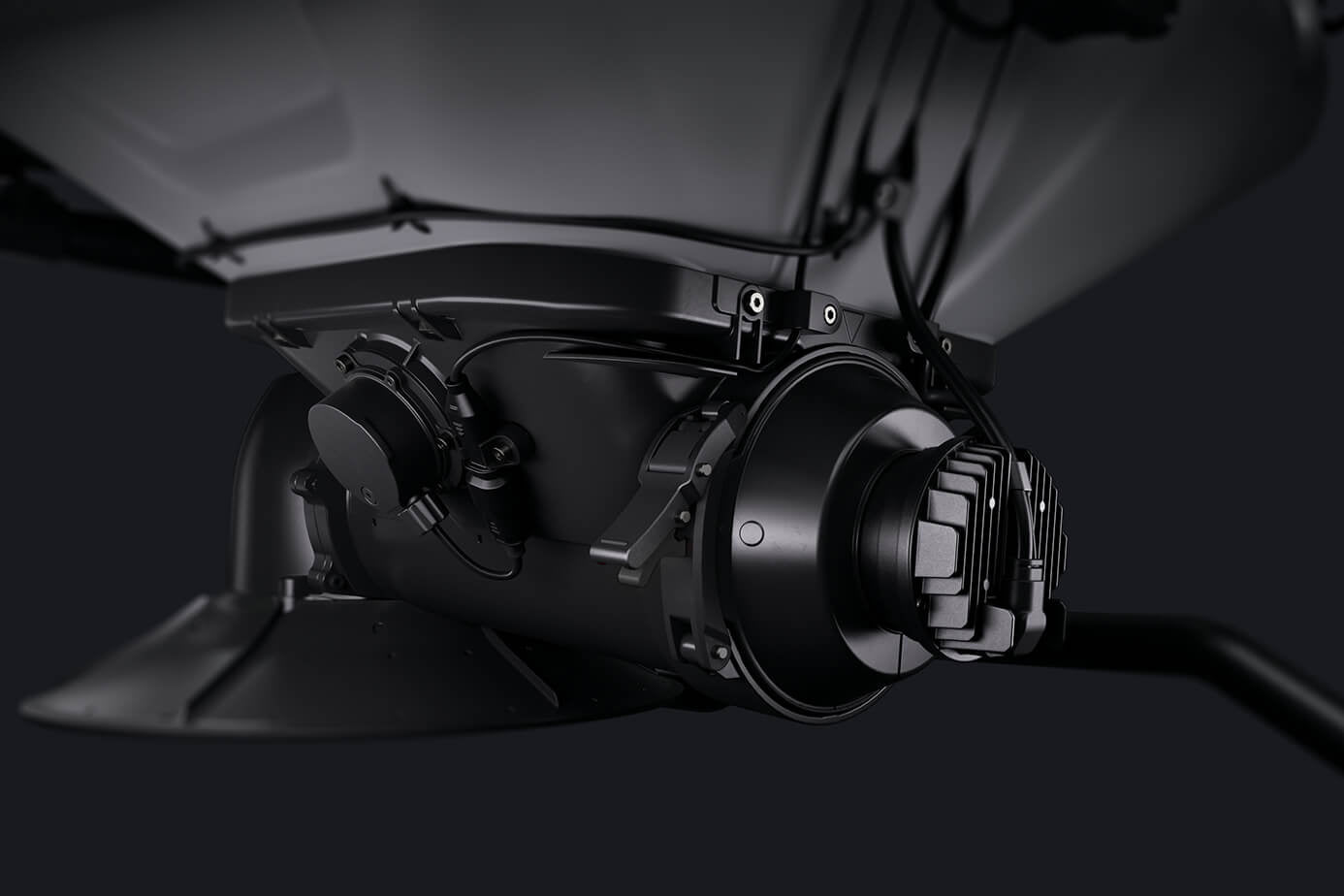
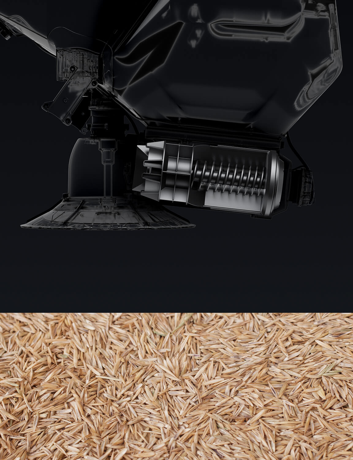
Centrifugal Spreader Disc
Ensures uniform spreading across the entire flow range with outstanding results. Features a stainless steel cap for durability and strength.
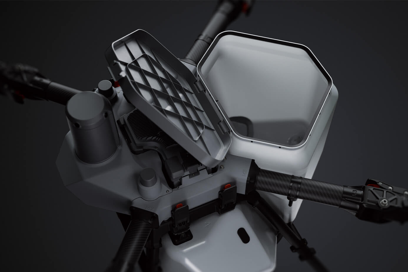
Large Loading Gate
Allows for easy and convenient bulk loading.
Four Feeder Types
-
Extra-Large Feeder
Suitable for granulars such as fertilizers, wheat seeds, granular fungicides, feed, etc.
Recommended application rate: 75-750 kg per hectare.
Recommended particle size: 0.5-10 mm -
Large Feeder (Optional)
Suitable for granulars such as rice seeds, cover crop seeds, etc.
Recommended application rate: 75-270 kg per hectare.
Recommended particle size: 4-10 mm -
Medium Feeder
Suitable for granulars such as rice seeds.
Recommended application rate: 22.5-120 kg per hectare.
Recommended particle size: 4-6 mm -
Small Feeder (Optional)
Suitable for granulars such as rapeseed, granular herbicides, grass seeds, granular insecticides, etc.
Recommended application rate: 3-22.5 kg per hectare.
Recommended particle size: 0.5-4 mm.


Omnidirectional Sensing, Precise Obstacle Detection
-
LiDAR
Capable of capturing dense spatial point cloud up to 300,000 points per second, providing a detailed view of complex terrains.
-
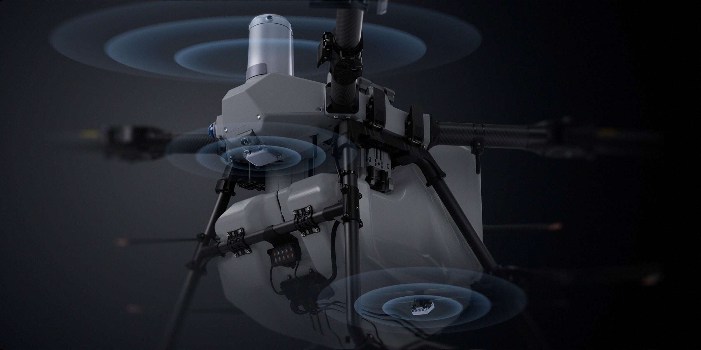
Millimeter-Wave Radar
The front radar performs 5,000 vertical airspace scans per second combined with 360° horizontal mechanical rotation scanning, along with a rear radar[12] offering a more comprehensive detection range.
-
Penta-Vision System[2]
The quad-vision system, paired with an FPV low-light full-color camera, facilitates unrestricted viewing of flight scenes in front, behind, left, right, and below, while intelligently identifying obstacles. The FPV camera employs virtual gimbal technology, offering an ultra-wide field of view complemented by stabilization algorithms, to achieve electronic image stabilization for smoother, more fluid footage.
-
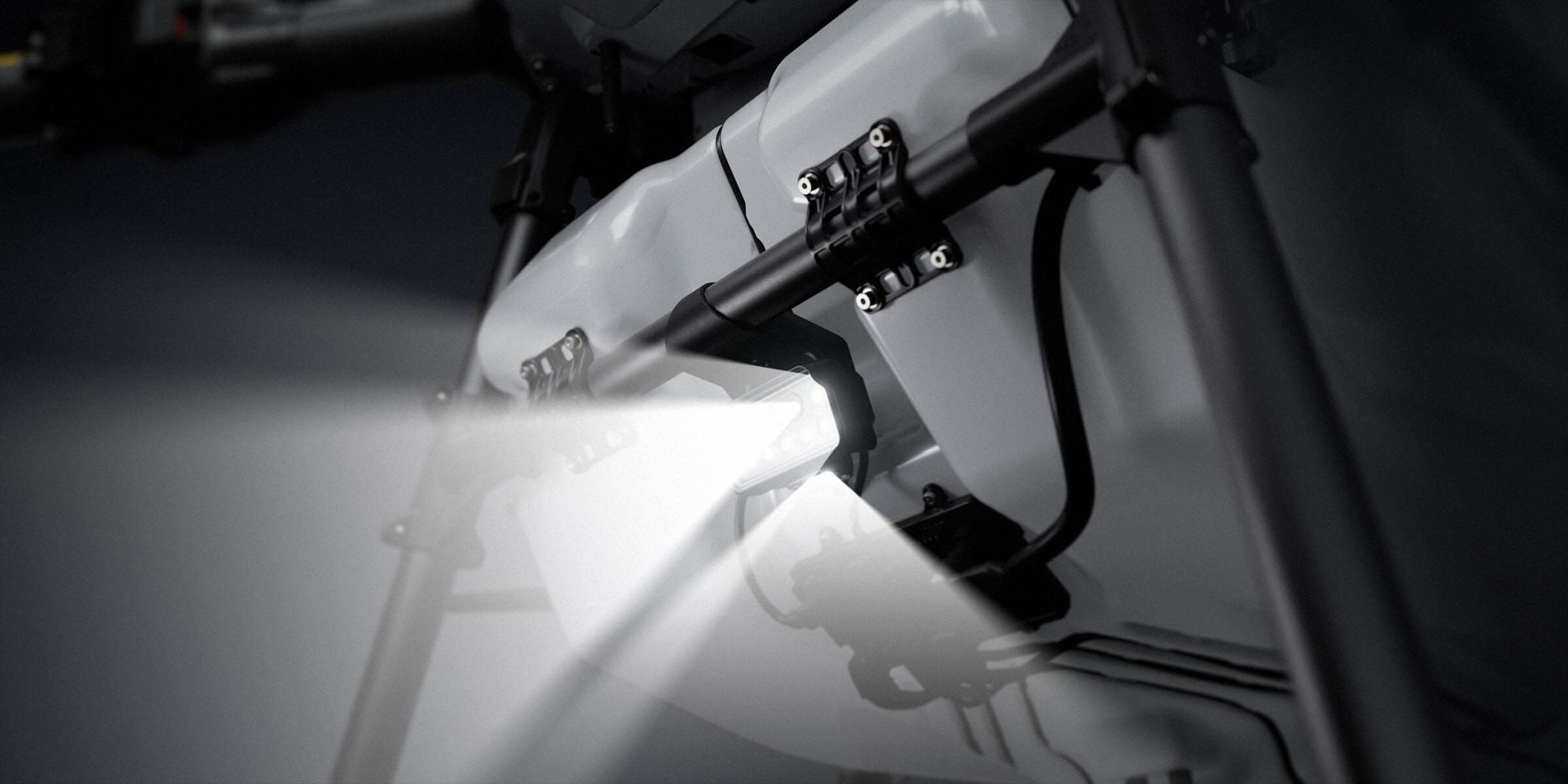
Night Navigation Light[13]
In addition to the existing low beam lights, new front-facing high beams and downward supplemental lighting have been added, ensuring safer nighttime operations.


AR Safety Assistance
The system can detect various obstacle types, including wires[29], poles, high-voltage towers, and trees. It intelligently selects the optimal path, ensuring smooth and seamless bypassing around obstacles.
The system automatically remembers obstacle locations, enabling more precise bypassing during subsequent flights. Users can save obstacles to a field with a single click, increasing safety with every flight.
The system can achieve Terrain Following of slopes up to 90° without prior mapping. It also supports intelligent obstacle bypassing[2], addressing the operational requirements of most mountainous and orchard environments with efficiency and precision.
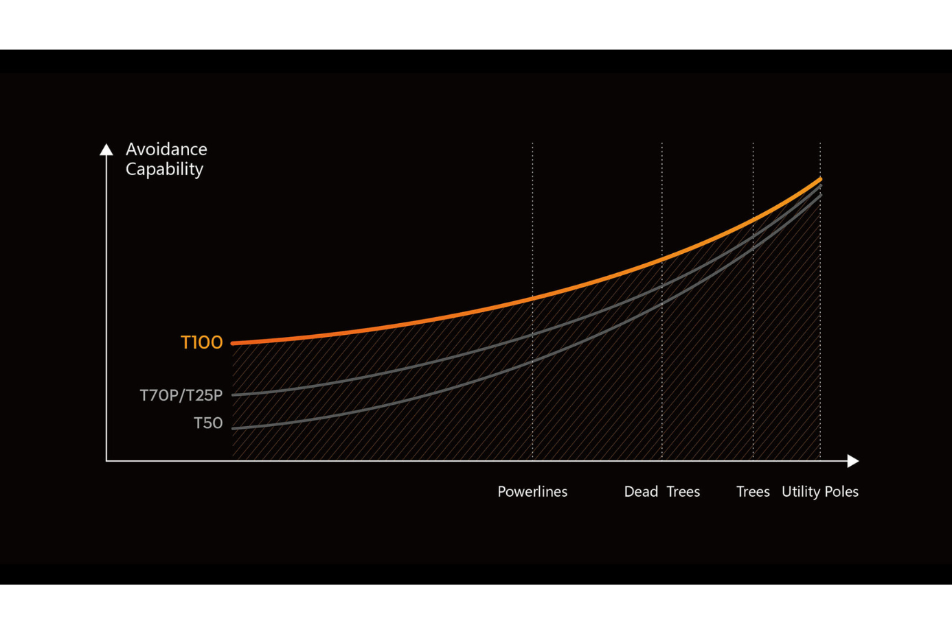
Enhanced Obstacle Avoidance Capabilities
With advanced multi-sensor fusion and upgraded algorithms, the T100 achieves a higher success rate in avoiding various obstacles. Its precision in detecting smaller obstacles is significantly improved, ensuring safer and more reliable operations[2].
Lift System—Your Transport Assistant
-
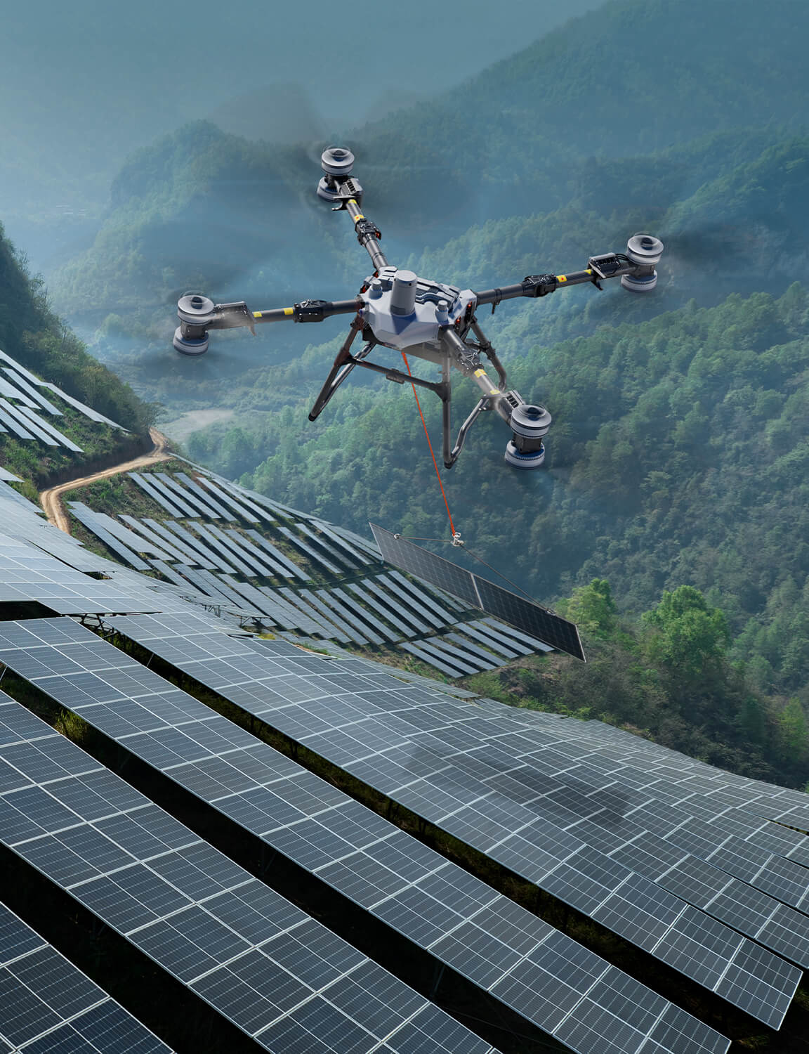
Solar Panels
-
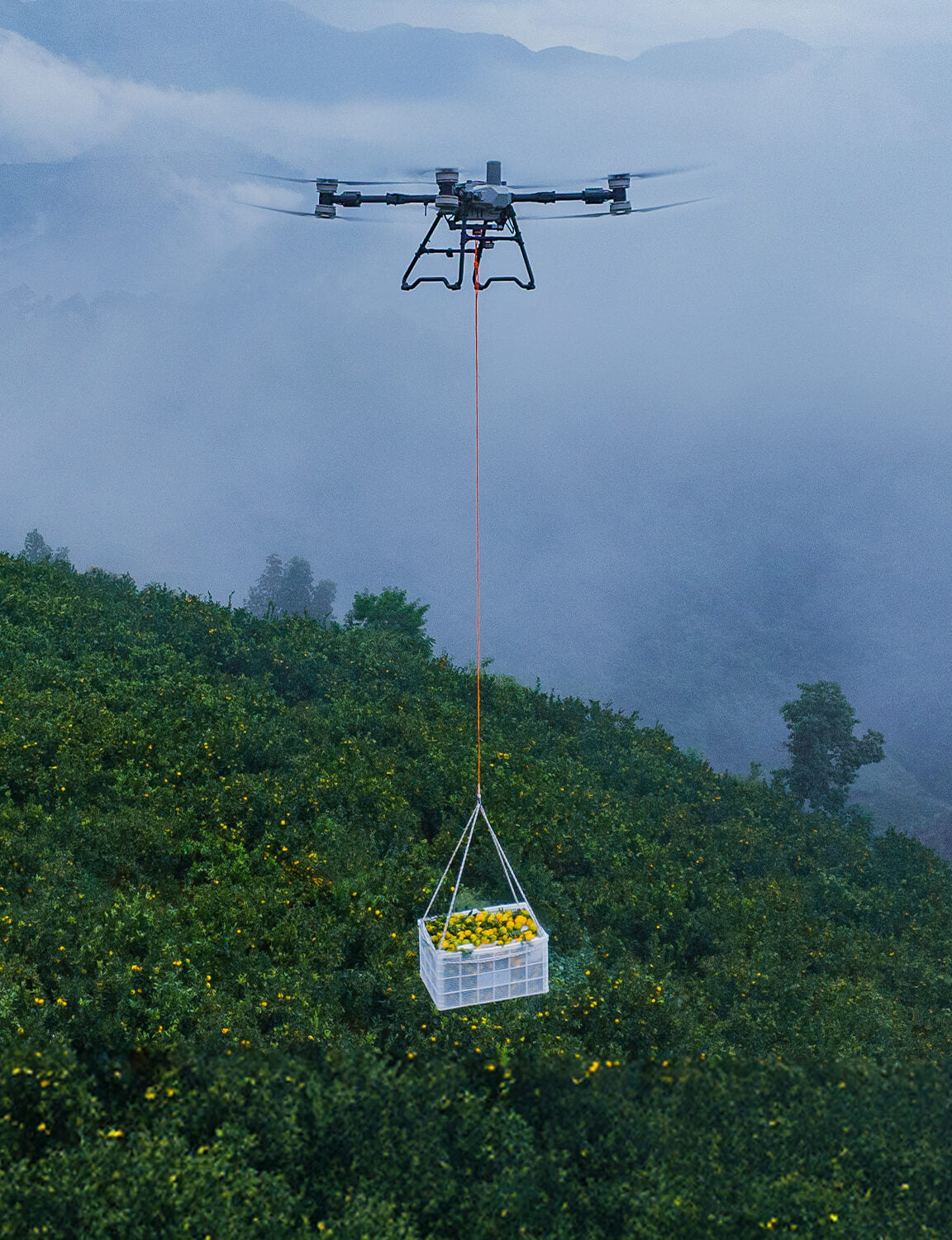
Fruits
-
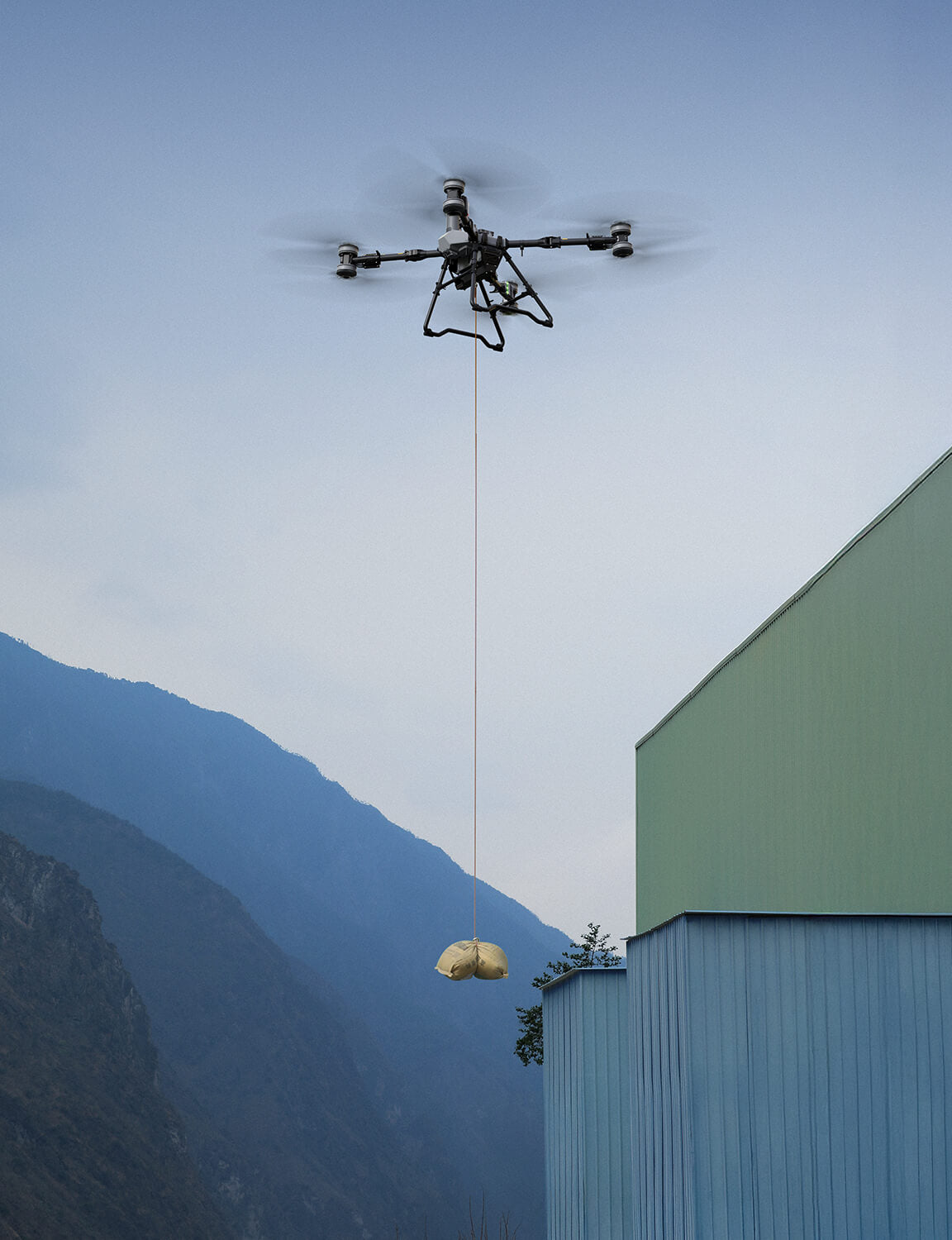
Building Materials
-
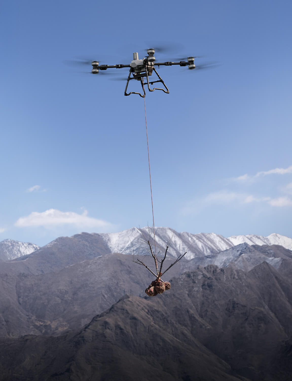
Saplings


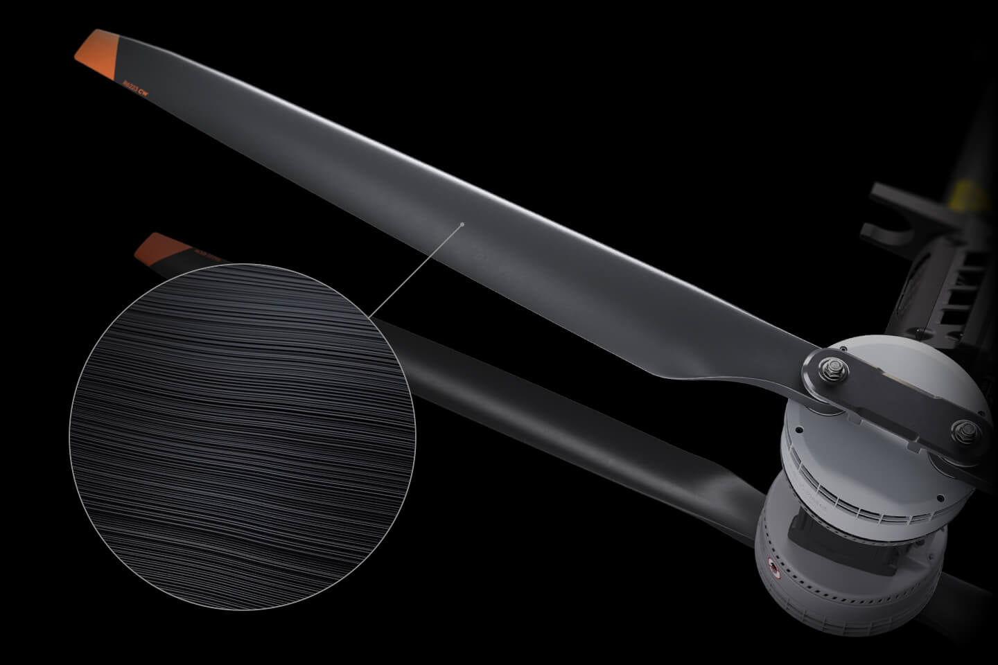
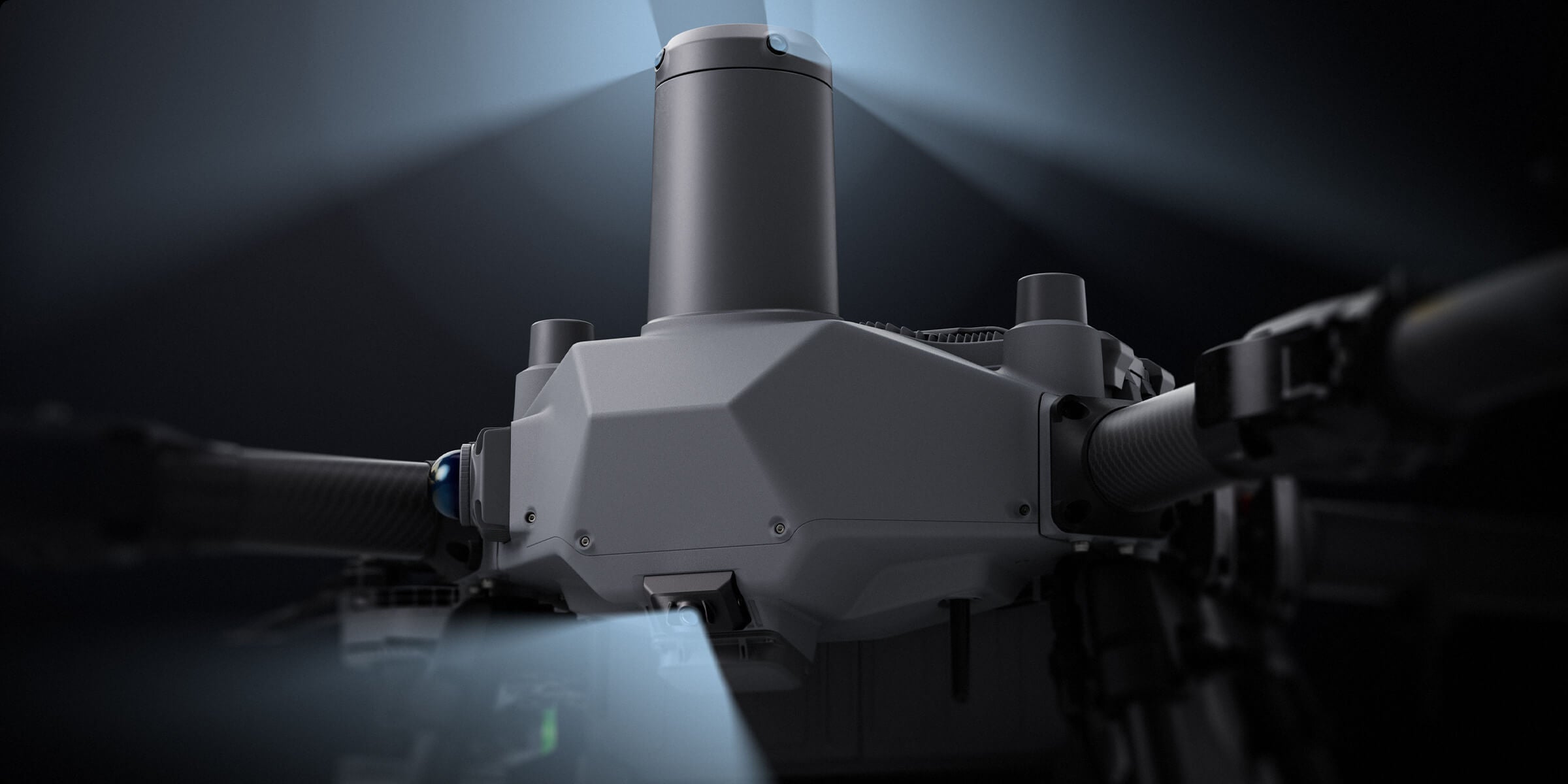
62-Inch Carbon Fiber Propellers
Carbon fiber propellers offer greater rigidity and lighter weight, resisting deformation even at high temperatures. With optimized airfoil and increased diameter, efficiency is improved by 32%[7].
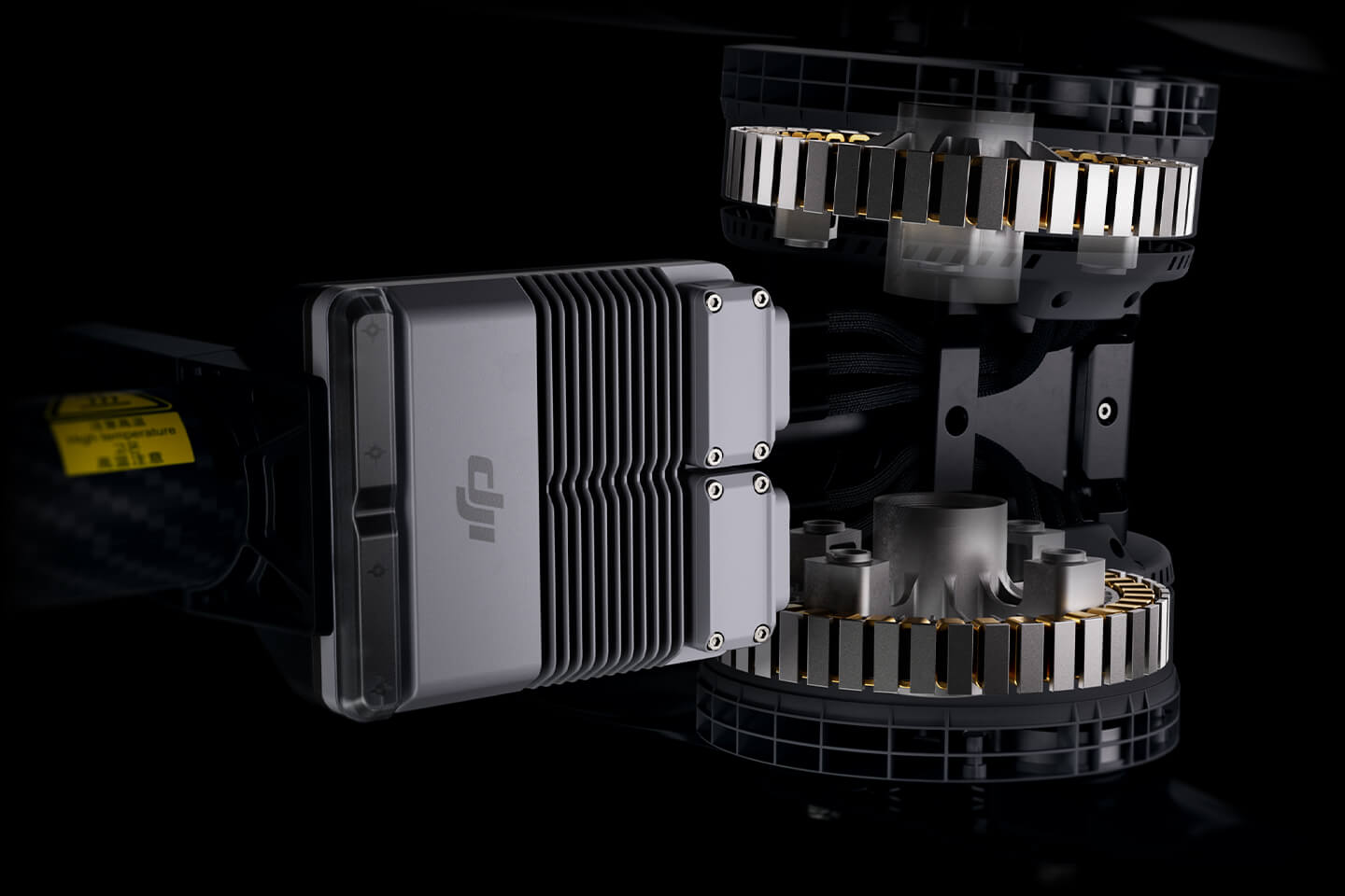
Motors and ESCs
Larger motors, more torque. 420A electronic speed controllers ensure stable and reliable operation, delivering faster response times.