


If you have any questions, you are always welcome to contact us. We'll get back to you as soon as possible, within 24 hours on weekdays.
-
Shipping Information
We offer reliable shipping across the United States. Orders over $599 qualify for free standard shipping.
Shipping options and estimated delivery times are shown at checkout and may vary by product and destination.
Products containing lithium-ion batteries may be subject to special shipping and carrier requirements.
For large equipment or enterprise orders, please contact our sales team for shipping assistance.
-
Customer Support
Need help choosing the right product, checking an order, or troubleshooting a product?
Our team can assist with product selection, order status, shipping, warranty, technical support, and general product questions.
Sales & Product Inquiries
Phone: +1 (888) 356-6818
Email: sales@droneroboticstec.comTechnical Support
+1 (888) 356-6818 Ext. 804 — Christopher
+1 (888) 356-6818 Ext. 806 — LucasWorking Hours
Mon–Fri: 9:00 AM–5:00 PM PST -
Contact Us
Have a question before placing an order?
Contact our sales team for product recommendations, availability, pricing, enterprise solutions, and bulk orders.
Sales Team
Phone: +1 (888) 356-6818
Email: sales@droneroboticstec.comFor enterprise, commercial, bulk, or dealer inquiries, we're happy to help you find the right solution.
FJD Trion P1 SLAM LiDAR Scanner
Capture reality faster with a lightweight handheld LiDAR scanner designed for professional 3D reality capture in indoor, outdoor, underground, and GPS-denied environments.
With 200,000 points per second, real-time point cloud visualization, a 360° × 59° field of view, and up to 2 cm relative accuracy, P1 turns a walk-through into usable 3D spatial data.
Turn a Walk Around the Site Into 3D Data
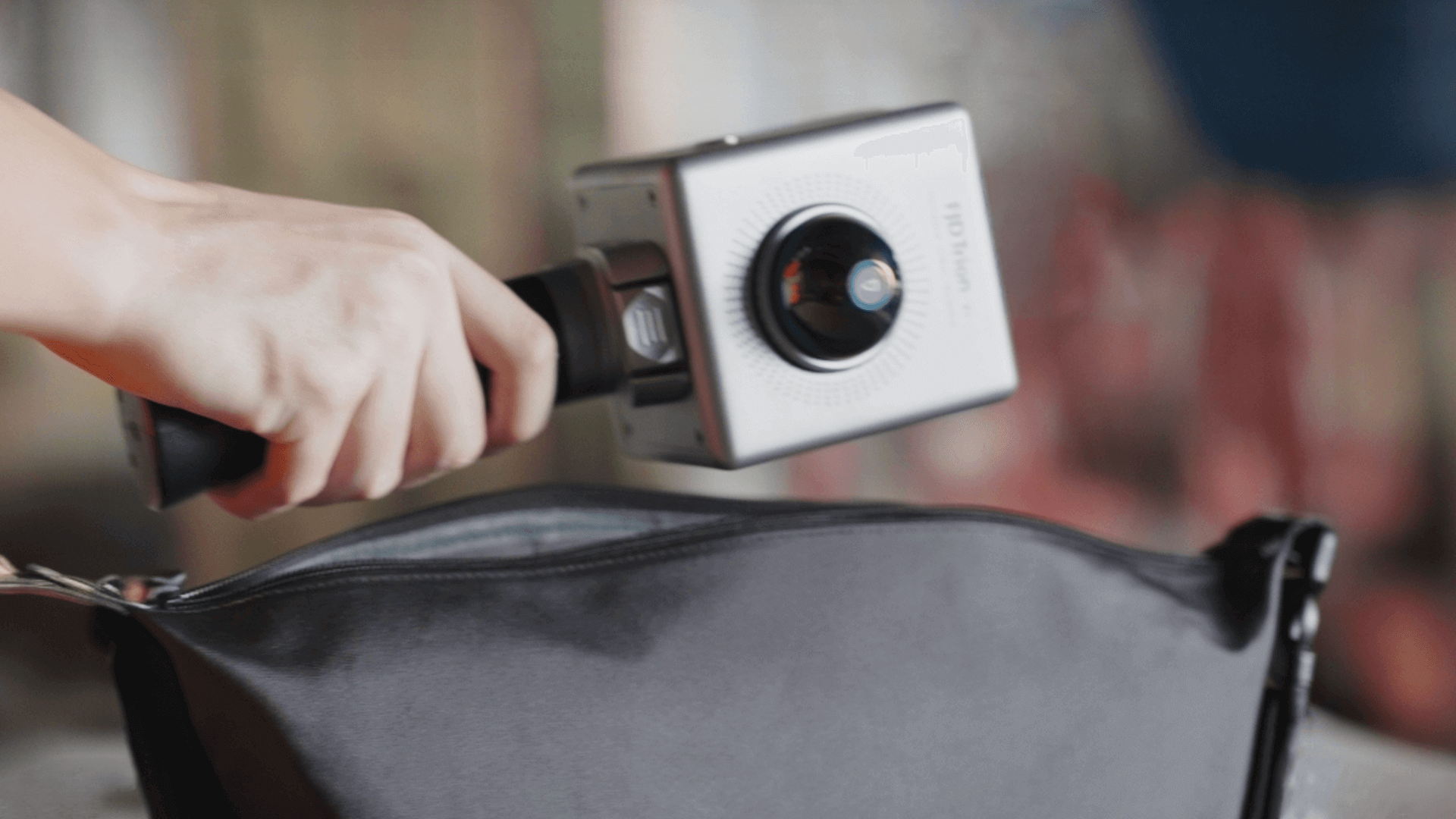
FJD Trion P1 combines SLAM-based positioning and LiDAR scanning into a portable system that lets you capture spatial information simply by walking through the environment.
Instead of relying on complex scanning setups, P1 is designed for fast field capture and immediate feedback during the scan.
Indoor. Outdoor. Underground.
P1 is designed to capture environments where traditional surveying workflows can become difficult or time-consuming. Its SLAM technology enables mobile scanning across a wide range of real-world environments, including locations with limited GNSS availability.
Professional LiDAR Performance in a Portable System
P1 combines high-speed LiDAR acquisition, wide field of view, real-time processing, and a lightweight handheld design for efficient field capture.
Points per Second
High-speed point acquisition for efficient 3D reality capture.
Scanning Range
Up to 70 m at 80% reflectivity and 40 m at 10% reflectivity.
Horizontal FOV
A 360° horizontal field of view helps capture surrounding environments during mobile scanning.
Lightweight Design
Portable enough for field teams to carry and operate during extended scanning workflows.
See the Point Cloud While You Scan
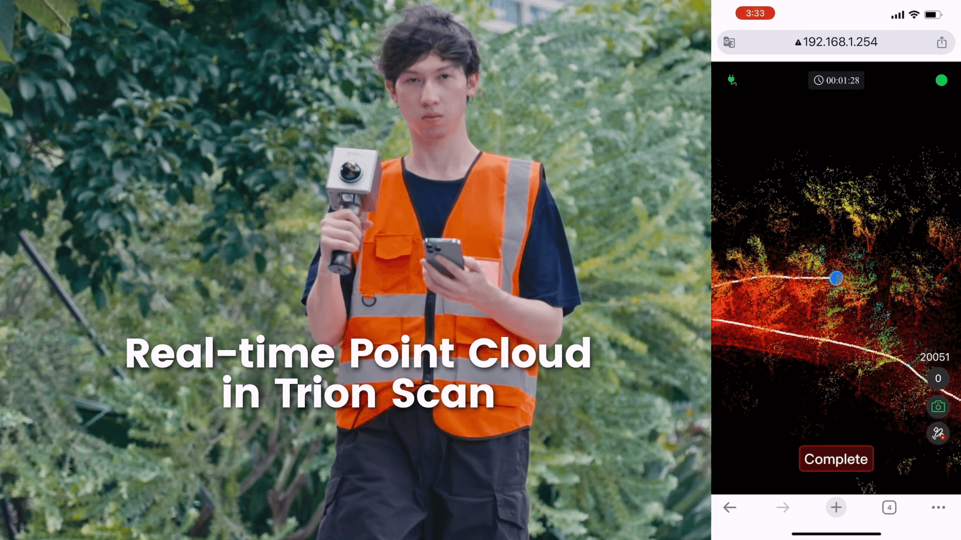
With FJD Trion Scan, operators can view point cloud data in real time while collecting field data. This makes it easier to monitor the scanning process and identify areas that may require additional coverage.
- Real-time point cloud preview
- Real-time point cloud processing
- Continue Scanning support
- Hyperdense+ support
- Scan file management through Trion Scan
One Field Capture. Multiple Ways to Use the Data.
P1 supports a complete reality-capture workflow from field scanning and point cloud inspection to processing, measurement, modeling, and collaboration.
Scan
Walk through the environment with P1 while monitoring the captured point cloud in real time.
Process
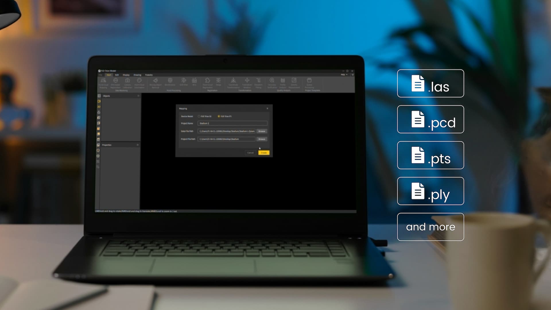
Export captured point cloud data and process it in FJD Trion Model or compatible third-party software.
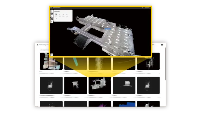
Deliver & Share
Create project deliverables and share spatial data with teams, clients, and other project stakeholders.
Built for the Tools You Already Use
P1 generates universal point cloud data that can be imported into FJD Trion Model or compatible third-party software for classification, registration, measurement, and further analysis.
Depending on the project workflow, captured data can support floor plans, contour maps, distance measurements, area and volume calculations, forest analysis, 3D models, and more.
From Field Capture to Final Deliverable
P1 integrates with the FJD Trion software ecosystem to help move projects from data collection to processing and sharing.
FJD Trion Scan
Real-time scanning control, point cloud preview, and scan file management.
FJD Trion Model
Process point cloud data and generate project-specific analysis and reports.
Model for Tablets
Support on-site point cloud processing and project preview on compatible iPadOS and Android devices.
Model Web
Share spatial data online and collaborate across project teams.
One Scanner. A Wide Range of Reality-Capture Workflows.
P1 can support professional workflows across construction, property assessment, public safety, forestry, and robotics.

Architecture & Construction
Building surveys, as-built documentation, floor plans, scan-to-CAD/BIM, and stockpile measurements.

Public Safety
Quickly capture accident, incident, and forensic scenes as detailed spatial records.

Forestry & Vegetation
Analyze tree inventory, crown structure, trunk dimensions, and vegetation environments using point cloud data.
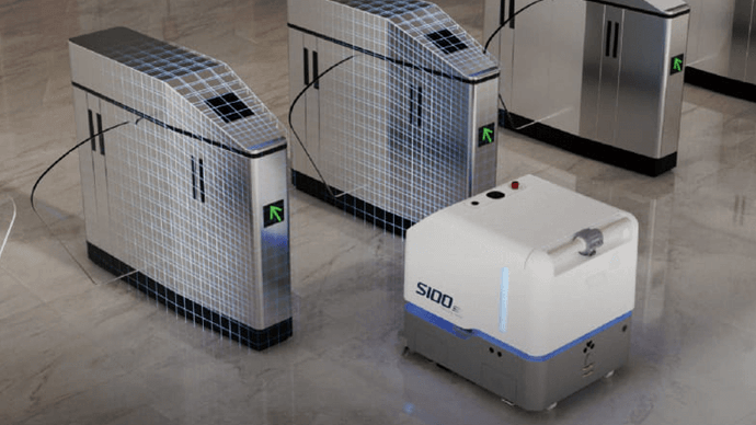
Robotics
Support environment mapping, route planning, and robot obstacle-avoidance workflows.
Adapt P1 to Your Field Workflow
P1 can be configured with additional equipment to expand reality-capture capabilities for different environments and project requirements.
Panoramic Capture
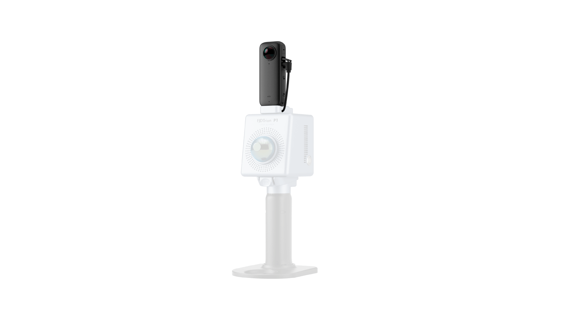
Integrate a compatible Insta360 X3 camera to capture 360° RGB video alongside LiDAR scanning.
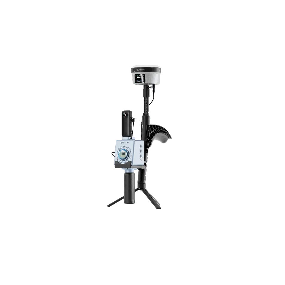
Georeferenced Scanning
Integrate GNSS equipment for workflows that require georeferenced point cloud data.
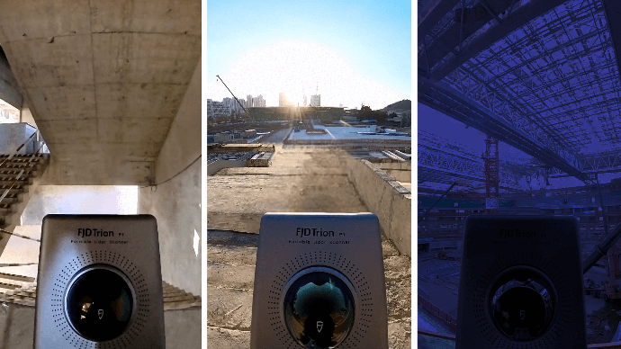
Hard-to-Reach Areas
Flexible mounting options can extend P1 into specialized mobile and robotic mapping workflows.
FJD Trion P1 Specifications
Technical specifications based on the current FJD Trion P1 product information.
| Relative Accuracy | Up to 2 cm* — tested under experimental conditions |
| Scanning Range | 40 m @ 10% reflectivity; 70 m @ 80% reflectivity |
| Laser Wavelength | 905 nm |
| Laser Rating | Eye-Safety Class I |
| LiDAR Field of View | 360° × 59° |
| Number of Laser Heads | 1 |
| Point Rate | 200,000 points/second |
| Point Cloud Processing | Real-time processing |
| Point Cloud Display | Real-time point cloud preview |
| Continue Scanning | Supported |
| Hyperdense+ | Supported |
| Weight | 1 kg, excluding camera and baseplate |
| Dimensions | 160 × 120 × 270 mm, excluding camera |
| Internal Memory | 512 GB |
| Data Transmission | USB 3.0 / Wi-Fi 2.4 GHz |
| Operating Temperature | -10°C to 45°C |
| Power Source | Rechargeable grip battery |
| Power Supply | 10.8 V, 3 A |
| Power Interface | USB Type-C |
| Power Consumption | 12 W, scanner only |
| Battery Life | Approx. 2 hours at room temperature, scanner only |
| Compatible Panoramic Camera | Insta360 X3 |
| Camera Resolution | 5760 × 2880 @ 30 fps |
| Camera FOV | 360° |
| RTK Accuracy | H: 8 mm + 1 ppm RMS / V: 15 mm + 1 ppm RMS |
| Positioning Rate | 10 Hz |
| PPK | Supported |
* Relative accuracy is tested under experimental conditions. Actual results may vary depending on environment, scanning conditions, workflow, and other factors.
Capture More. Measure Better. Build From Reality.
From construction and property assessment to forestry, public safety, and robotics, FJD Trion P1 provides a flexible LiDAR reality-capture solution for professional field teams.