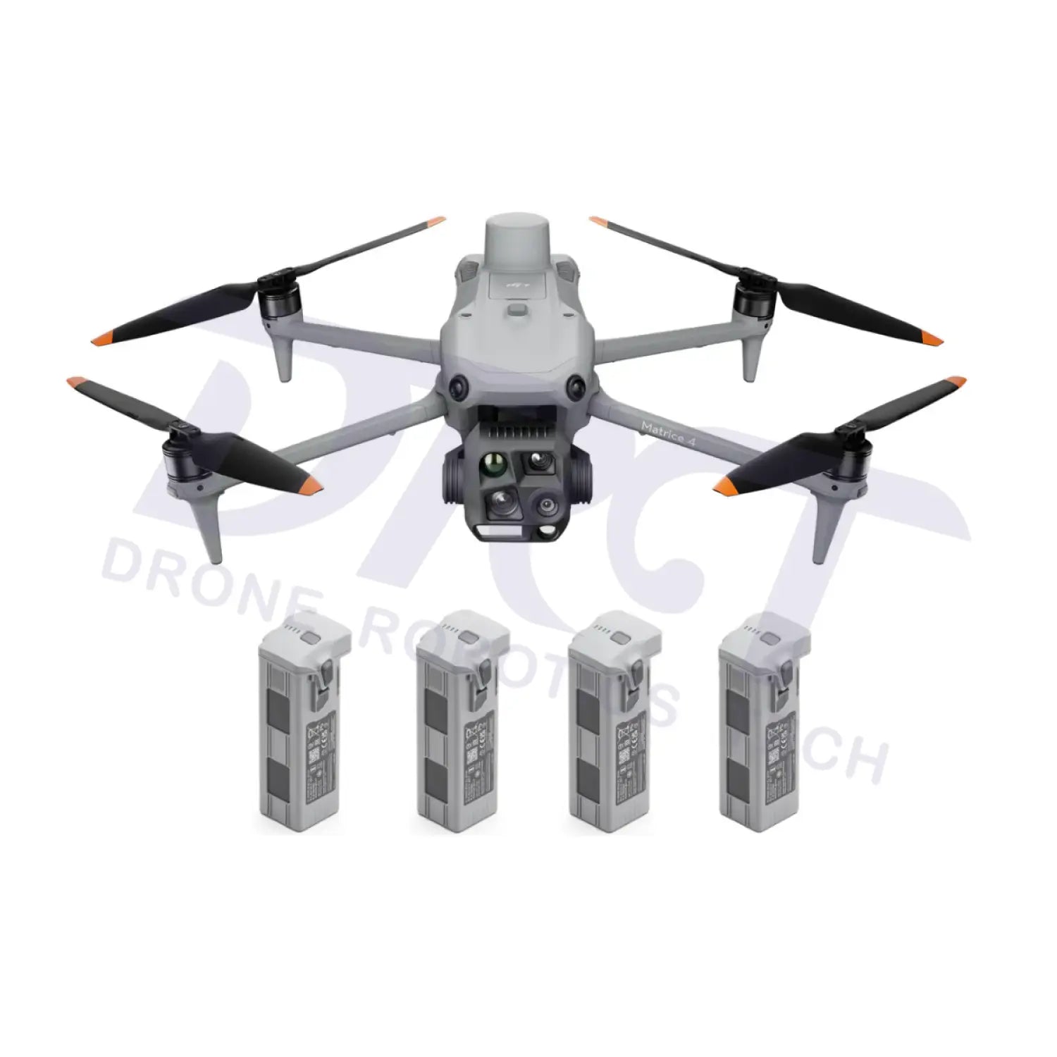
DJI Matrice 4E Drone Bundle with 3 Extra Batteries
Recommended Add-ons
Build Your KitAdd popular accessories to your cart before checkout.


Free shipping over $599.00
Money Back Guarantee
Pairs well with
DJI Matrice 4E Drone Bundle with 3 Extra Batteries
If you have any questions, you are always welcome to contact us. We'll get back to you as soon as possible, within 24 hours on weekdays.
-
Shipping Information
Use this text to answer questions in as much detail as possible for your customers.
-
Customer Support
Use this text to answer questions in as much detail as possible for your customers.
-
FAQ’s
Use this text to answer questions in as much detail as possible for your customers.
-
Contact Us
Use this text to answer questions in as much detail as possible for your customers.
DJI Matrice 4E Drone Bundle with 3 Extra Batteries
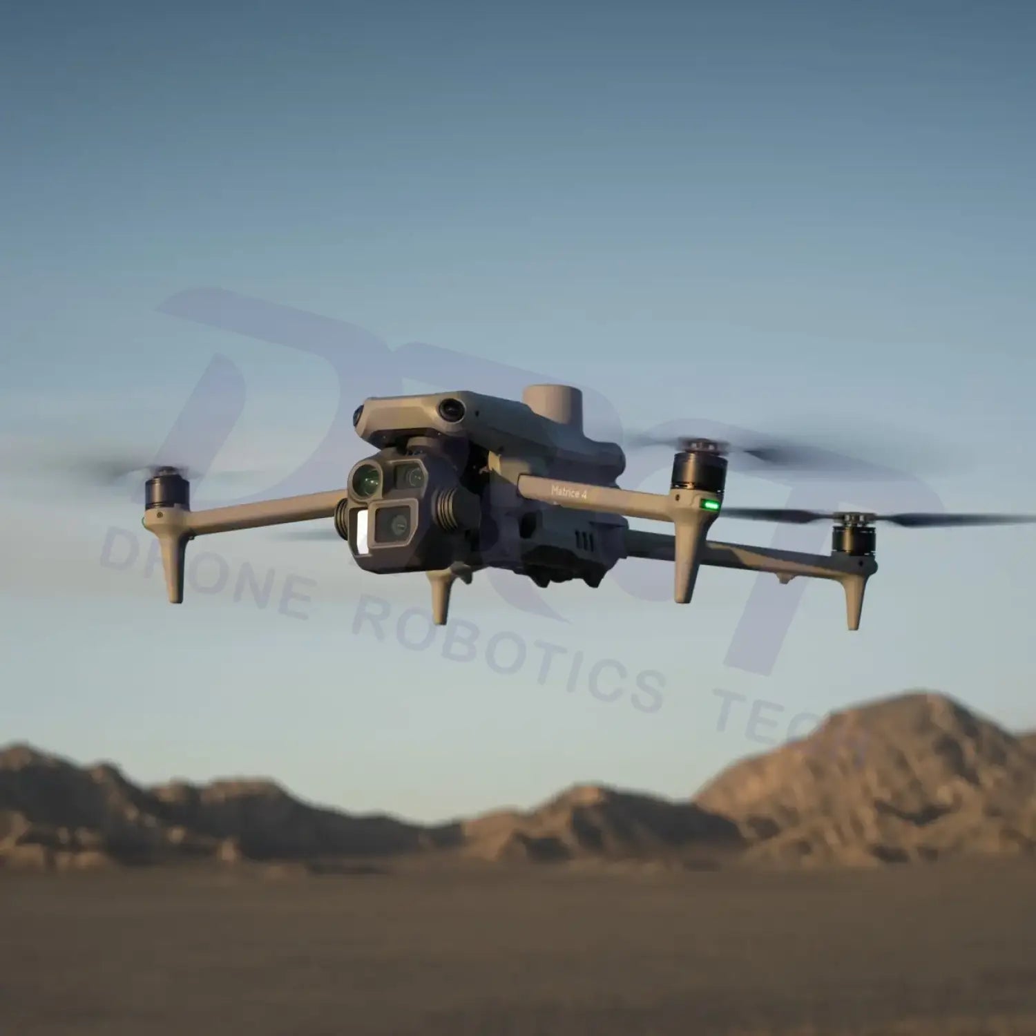
Next-generation enterprise drone engineered for precision surveying, intelligent mapping, 3D reconstruction, and industrial inspection workflows.
The DJI Matrice 4E is part of the DJI Matrice 4 Series, designed specifically for geospatial professionals, engineering teams, infrastructure inspection, and large-scale mapping operations. Combining AI-powered flight intelligence, high-efficiency imaging systems, RTK precision positioning, and enterprise-grade safety features, the Matrice 4E delivers a new standard for aerial surveying and digital reconstruction workflows.
Intelligent Mapping & AI-Powered Operations

Precision Mapping System
Equipped with a high-performance wide-angle camera featuring a mechanical shutter, the Matrice 4E minimizes motion blur during high-speed aerial surveying missions. It supports 5-directional oblique capture and 3-directional orthographic capture for efficient large-scale mapping workflows.

Advanced Flight Safety
The Matrice 4E integrates GNSS and Vision Positioning Systems with omnidirectional obstacle sensing technology to improve flight safety and navigation reliability in complex operational environments.

Enterprise Ecosystem Integration
Fully compatible with DJI Terra, DJI Pilot 2, D-RTK 3 Multifunctional Station, and DJI Enterprise accessories for streamlined aerial surveying and inspection workflows.
Advanced 3D Reconstruction Workflows

Smart 3D Capture
DJI Matrice 4E supports Smart 3D Capture workflows, enabling operators to generate preliminary models directly on the remote controller and automatically create optimized mapping routes for complex structures and irregular buildings.
Rapid Mapping Efficiency
Supporting fast interval shooting and intelligent route planning, the Matrice 4E significantly improves operational efficiency for large-area surveying missions while reducing redundant overlap during capture.
Engineering-Grade Accuracy
With RTK precision positioning and DJI Terra integration, the Matrice 4E supports highly accurate orthomosaic generation, terrain modeling, digital twins, volumetric analysis, and BIM workflows.
Enterprise Inspection & Surveying Features
| Feature | Enterprise Benefit |
|---|---|
| Mechanical Shutter Camera | Improves mapping accuracy and reduces image distortion during high-speed flight missions. |
| 5-Directional Oblique Capture | Captures highly detailed building facades and structures for accurate 3D reconstruction. |
| 3-Directional Orthographic Capture | Increases orthomosaic efficiency while reducing operational flight time. |
| RTK Precision Positioning | Provides centimeter-level positioning accuracy for professional surveying operations. |
| AI Intelligent Flight Functions | Supports automated mission planning, smart route optimization, and intelligent operational workflows. |
| O4 Enterprise Transmission | Enables stable long-range image transmission with enhanced anti-interference performance. |
Designed for Professional Applications
Surveying & GIS
Generate orthomosaics, topographic maps, cadastral surveys, and GIS datasets with enterprise-level efficiency and precision.
Construction & Engineering
Monitor construction progress, calculate stockpile volumes, create digital twins, and streamline engineering documentation workflows.
Mining & Infrastructure
Ideal for mining analysis, utility inspection, corridor mapping, bridge inspection, and infrastructure asset management applications.
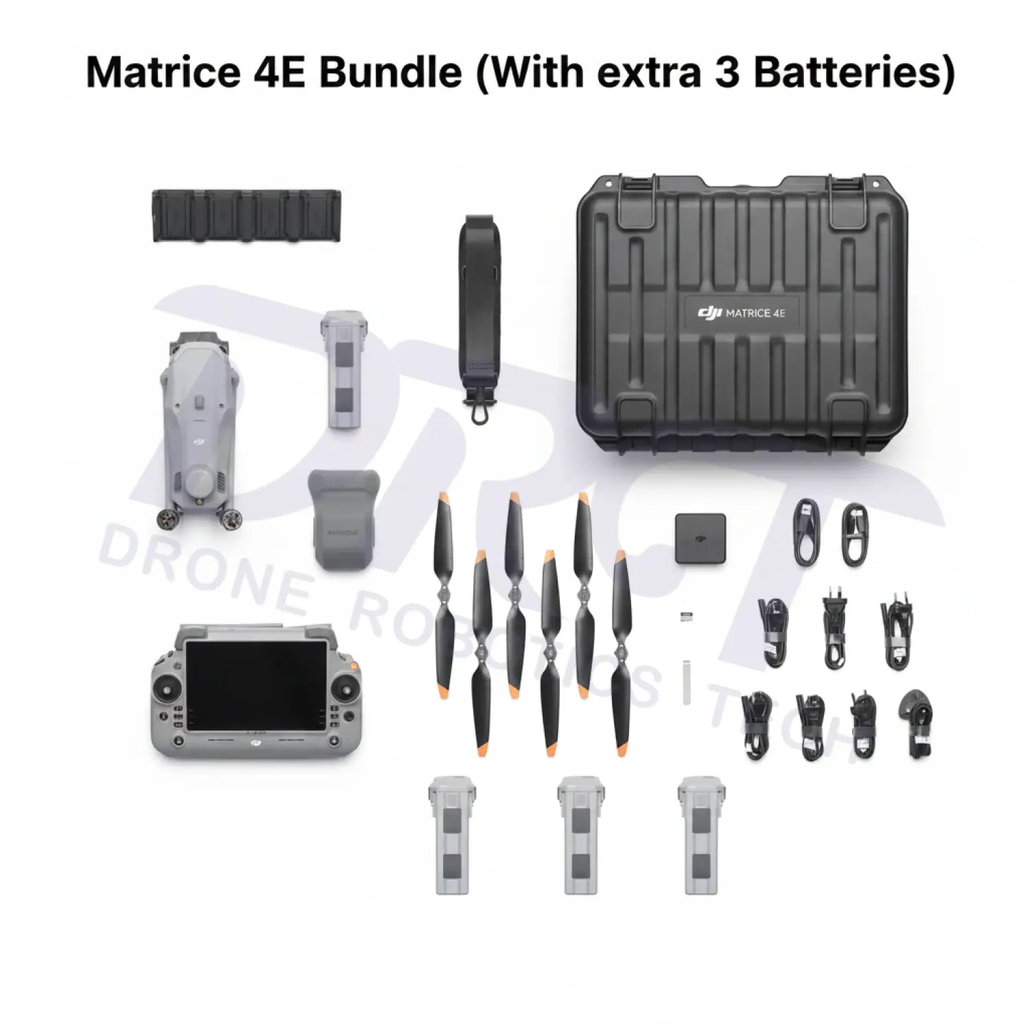
Bundle Highlights
| Included Item | Description |
|---|---|
| DJI Matrice 4E Aircraft | Enterprise drone platform optimized for mapping, surveying, and reconstruction workflows. |
| 3 Extra Intelligent Flight Batteries | Extended flight endurance for large-scale mapping and multi-location field operations. |
| DJI RC Plus 2 Enterprise | Professional enterprise remote controller with enhanced operational reliability. |
| DJI Enterprise Ecosystem | Supports DJI Terra, DJI Pilot 2, D-RTK 3, and enterprise-grade workflow integration. |
FAQ
What is the DJI Matrice 4E mainly used for?
The DJI Matrice 4E is designed for professional aerial surveying, GIS mapping, engineering inspection, digital twin generation, and industrial reconstruction workflows.
Does this bundle include extra batteries?
Yes. This bundle includes 3 extra intelligent flight batteries for longer field operations and reduced charging interruptions.
Does the Matrice 4E support DJI Terra?
Yes. The Matrice 4E is fully compatible with DJI Terra for orthomosaic generation, 3D reconstruction, terrain modeling, and mapping workflows.
Is RTK positioning supported?
Yes. The Matrice 4E supports RTK precision positioning for centimeter-level mapping accuracy.
Is DJI Care Enterprise available?
Yes. DJI Care Enterprise protection plans are available for eligible Matrice 4E aircraft to help reduce repair and replacement costs.