DJI Mavic 3 Multispectral (No Care)
CB.202210310429.01
Free shipping over $599. Oversize or freight parts may require shipping confirmation.
Genuine DJI replacement part for compatible Agras models.
Need help confirming the part? Contact us with your aircraft model, serial number, and photos.
DJI Mavic 3 Multispectral (No Care)
Send the aircraft model, serial number, material number, and photos of the damaged component. We can help verify the correct replacement part.
-
Confirm Compatibility
Before ordering, confirm the aircraft model, material number, and diagram reference. If you are not sure, contact us with your aircraft model, serial number, and photos of the damaged component.
-
Shipping Information
Most small parts ship by parcel carrier. Oversize items, large assemblies, batteries, tanks, arms, or other freight-class parts may require shipping confirmation before fulfillment.
-
Parts Support
Our team can help verify the correct DJI Agras replacement part using the part number, product photos, and aircraft information.
-
Contact Us
Questions about this part or a repair case? Contact Drone Robotics Tech before placing your order so we can help confirm compatibility.
Product Information
Product Details
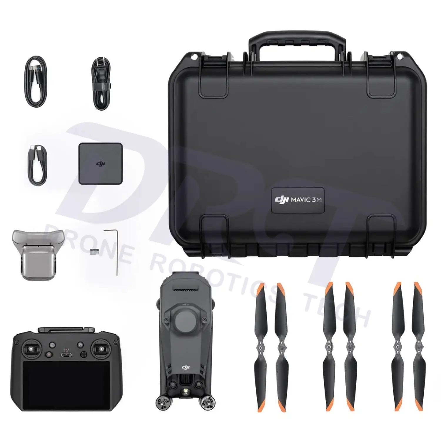
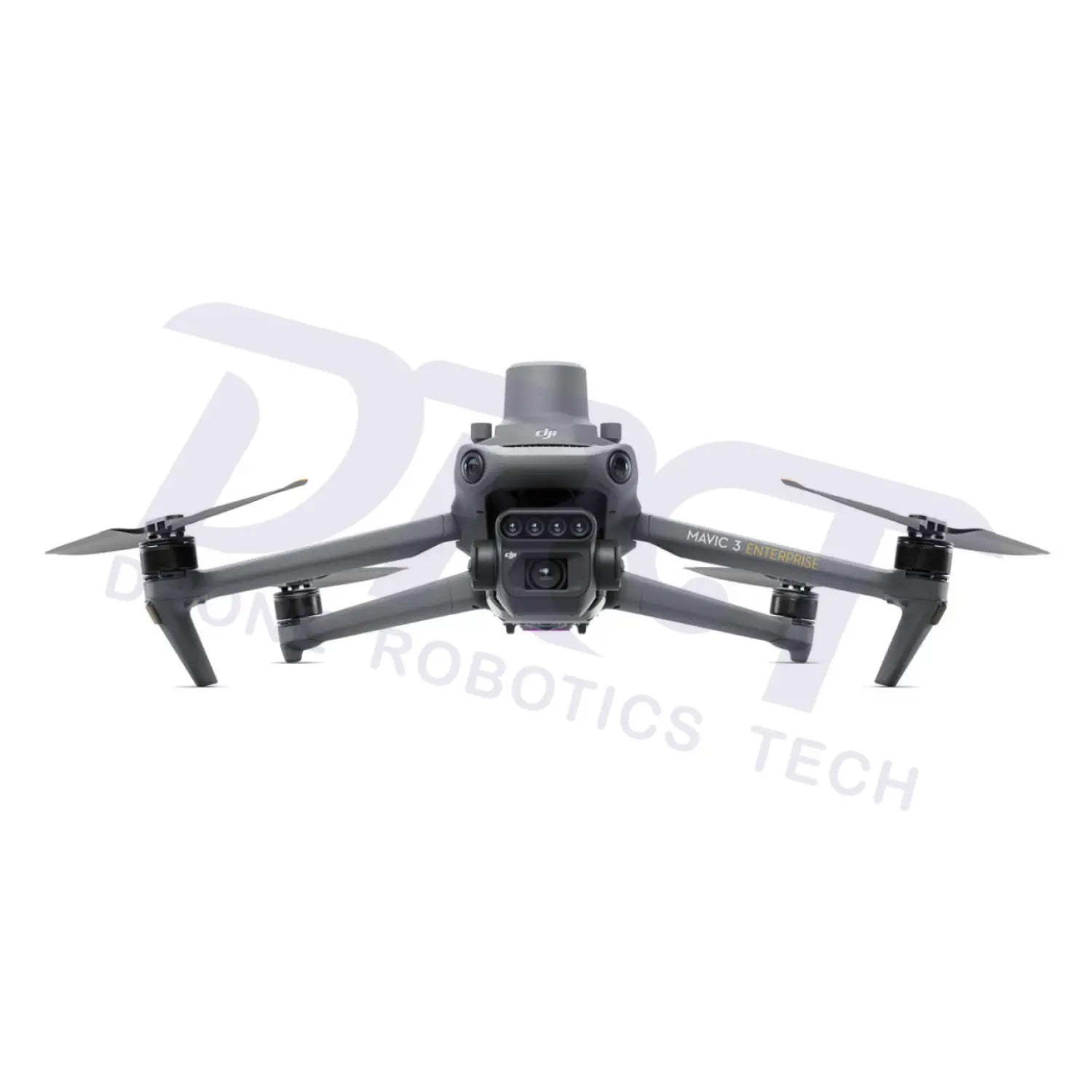
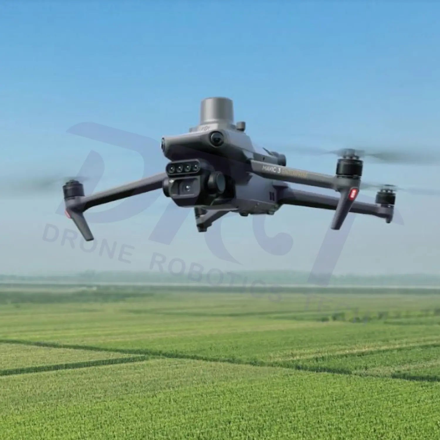
DJI Mavic 3 Multispectral (Mavic 3M)
Compact multispectral drone designed for precision agriculture, crop monitoring, environmental analysis, and intelligent aerial surveying.
DJI Mavic 3 Multispectral combines RGB imaging with advanced multispectral technology to provide actionable agricultural intelligence and high-efficiency field analysis. Equipped with a 20MP RGB camera, multispectral imaging system, RTK precision positioning, and centimeter-level mapping capability, the Mavic 3M helps growers, agronomists, and agricultural professionals make smarter decisions with accurate aerial data.
Multispectral Imaging System
20MP RGB Camera
Capture high-resolution visible-light imagery for agricultural mapping, scouting, and field documentation workflows with enhanced detail and clarity.
4 Multispectral Sensors
Integrated multispectral sensors capture Green, Red, Red Edge, and Near-Infrared spectral bands to analyze vegetation health and crop conditions invisible to the naked eye.
Sunlight Sensor
The built-in sunlight sensor captures solar irradiance and records it in an image file, allowing for light compensation of image data during 2D reconstruction. This results in more accurate NDVI results, as well as improved accuracy and consistency of data acquired over time.
Precision Agriculture Workflows
NDVI & Vegetation Analysis
Generate NDVI, NDRE, and vegetation index maps to monitor crop stress, nutrient conditions, irrigation efficiency, and overall plant health.
Precision Field Management
Identify crop variability, disease risk areas, water stress zones, and growth inconsistencies for more efficient agricultural management decisions.
Prescription Map Generation
Supports prescription map workflows for variable-rate spraying and precision agriculture operations integrated with DJI Agras platforms.
Enterprise Flight Performance
| Feature | Enterprise Benefit |
|---|---|
| RTK Precision Positioning | Provides centimeter-level positioning accuracy for precise aerial mapping and agricultural analysis. |
| 43-Minute Flight Time | Long endurance improves field coverage efficiency and reduces battery replacement frequency. |
| Omnidirectional Obstacle Sensing | Enhances operational safety during low-altitude agricultural flight missions. |
| Fast Mission Planning | Supports efficient route planning and automated field mapping workflows. |
| O3 Enterprise Transmission | Stable long-range image transmission with improved anti-interference capability. |
| DJI Terra & SmartFarm Compatibility | Supports agricultural analytics, mapping, and intelligent farm management workflows. |
Ideal Industry Applications
Precision Agriculture
Monitor crop growth, analyze field variability, optimize fertilizer use, and improve yield management with multispectral aerial intelligence.
Forestry & Environmental Monitoring
Evaluate vegetation coverage, forest health, environmental changes, and ecological conditions with accurate multispectral imaging data.
Agricultural Research
Support crop trials, scientific analysis, and agricultural research projects with repeatable and data-driven aerial surveying workflows.
FAQ
What is DJI Mavic 3 Multispectral mainly used for?
DJI Mavic 3 Multispectral is primarily designed for precision agriculture, crop health monitoring, NDVI mapping, vegetation analysis, and environmental monitoring.
What spectral bands does the Mavic 3M support?
The Mavic 3M supports Green, Red, Red Edge, and Near-Infrared spectral bands alongside a high-resolution RGB camera.
Does the DJI Mavic 3 Multispectral support RTK?
Yes. The aircraft supports RTK precision positioning for centimeter-level aerial surveying accuracy.
Can Mavic 3M generate NDVI maps?
Yes. The drone supports NDVI, NDRE, and multiple vegetation index workflows for agricultural analysis and crop monitoring.
Is DJI Terra compatible with Mavic 3 Multispectral?
Yes. DJI Mavic 3M supports DJI Terra for mapping, reconstruction, and agricultural analysis workflows
Compatibility & Part Verification
Please review the compatibility list, SKU, simplified part number, and diagram reference shown in the product description. If you are not sure whether this part fits your aircraft, contact us before ordering.
Shipping & Oversize Parts
Small replacement parts usually ship by parcel carrier. Oversize, freight, battery, tank, arm, or large assembly items may require shipping confirmation and may not qualify for standard checkout shipping rates.
Returns & Order Accuracy
Please verify the part number before ordering. Installed, used, damaged, or special-order repair parts may not be eligible for return. Contact us if you need help confirming the correct part.
Parts FAQ
Quick answers about compatibility, part verification, shipping, and returns.
How do I confirm this is the correct DJI Agras part?
Compare the SKU, DJI material number, simplified part number, part name, compatible models, and diagram reference before ordering. If you are not sure, contact us before placing the order.
What should I send if I am not sure which part I need?
Please send the aircraft model, serial number, clear photos of the damaged component, and any visible part number or label. This helps us verify the correct replacement part.
Are these genuine DJI parts?
Products listed as Genuine DJI Part are original DJI replacement components intended for repair, maintenance, or replacement use on compatible DJI Agras agricultural drones.
Why does one part show multiple compatible Agras models?
Some DJI Agras components are shared across multiple aircraft models. Always confirm the compatible models and DJI material number before ordering.
Do oversize parts ship the same way as small parts?
No. Oversize parts such as tanks, arms, landing gear, frames, batteries, or large assemblies may require freight or special shipping confirmation before fulfillment.
Can I return a DJI Agras replacement part?
Please verify the correct part before ordering. Installed, used, damaged, electrical, special-order, or repair-specific parts may not be eligible for return.