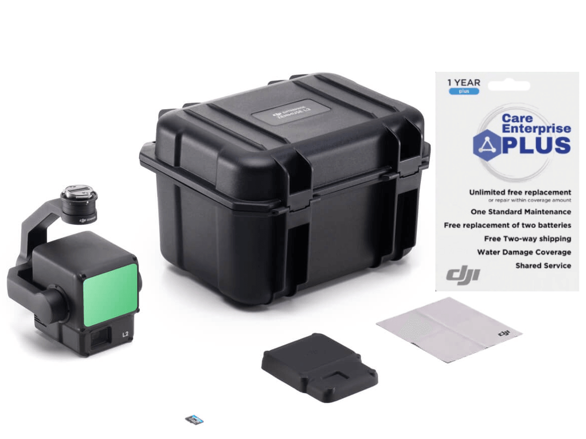
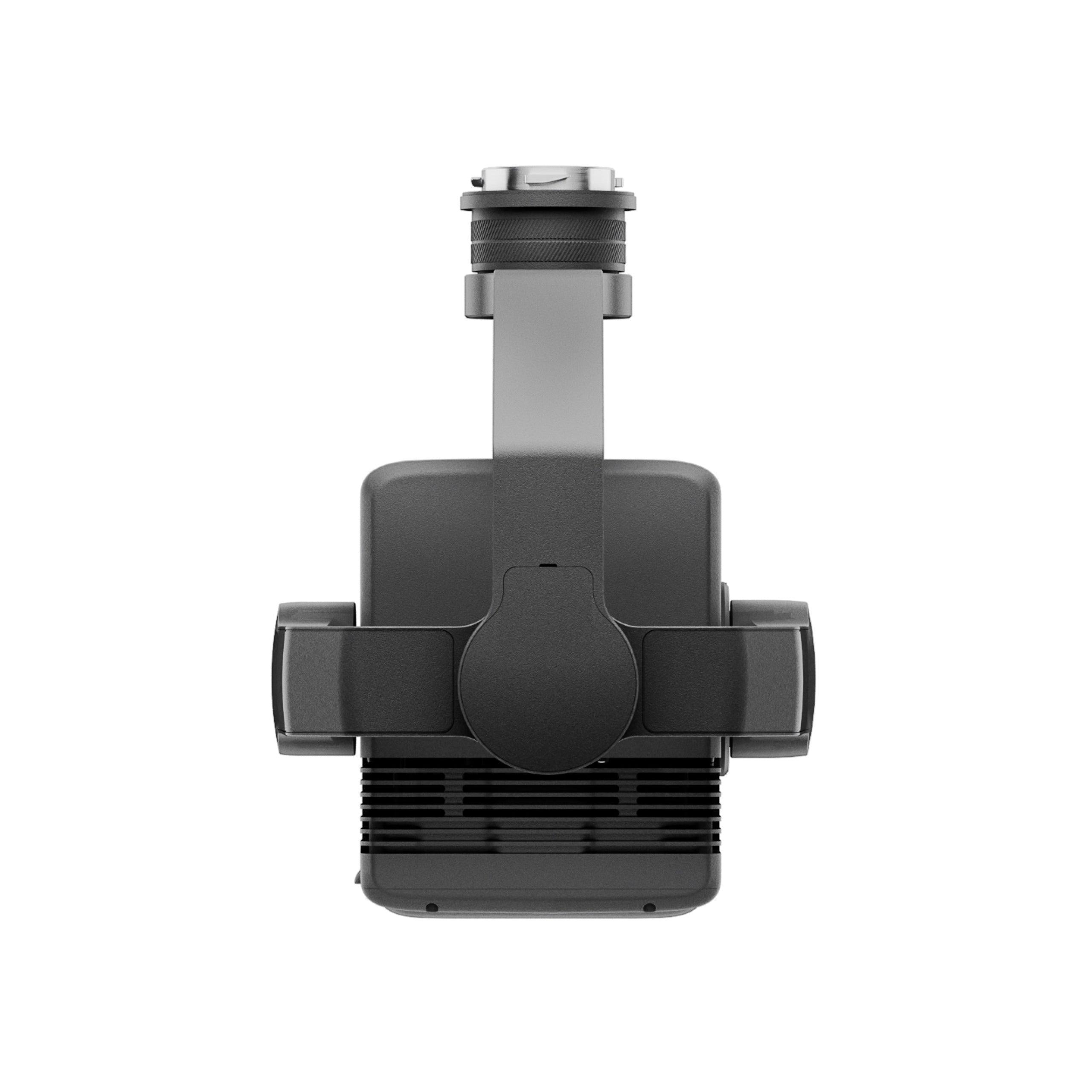
DJI Zenmuse L2 (NA) SP Plus (1 Year Plus)
CP.EN.00000505.01
Free shipping over $599.00
Money Back Guarantee
Pairs well with
If you have any questions, you are always welcome to contact us. We'll get back to you as soon as possible, within 24 hours on weekdays.
-
Shipping Information
Use this text to answer questions in as much detail as possible for your customers.
-
Customer Support
Use this text to answer questions in as much detail as possible for your customers.
-
FAQ’s
Use this text to answer questions in as much detail as possible for your customers.
-
Contact Us
Use this text to answer questions in as much detail as possible for your customers.
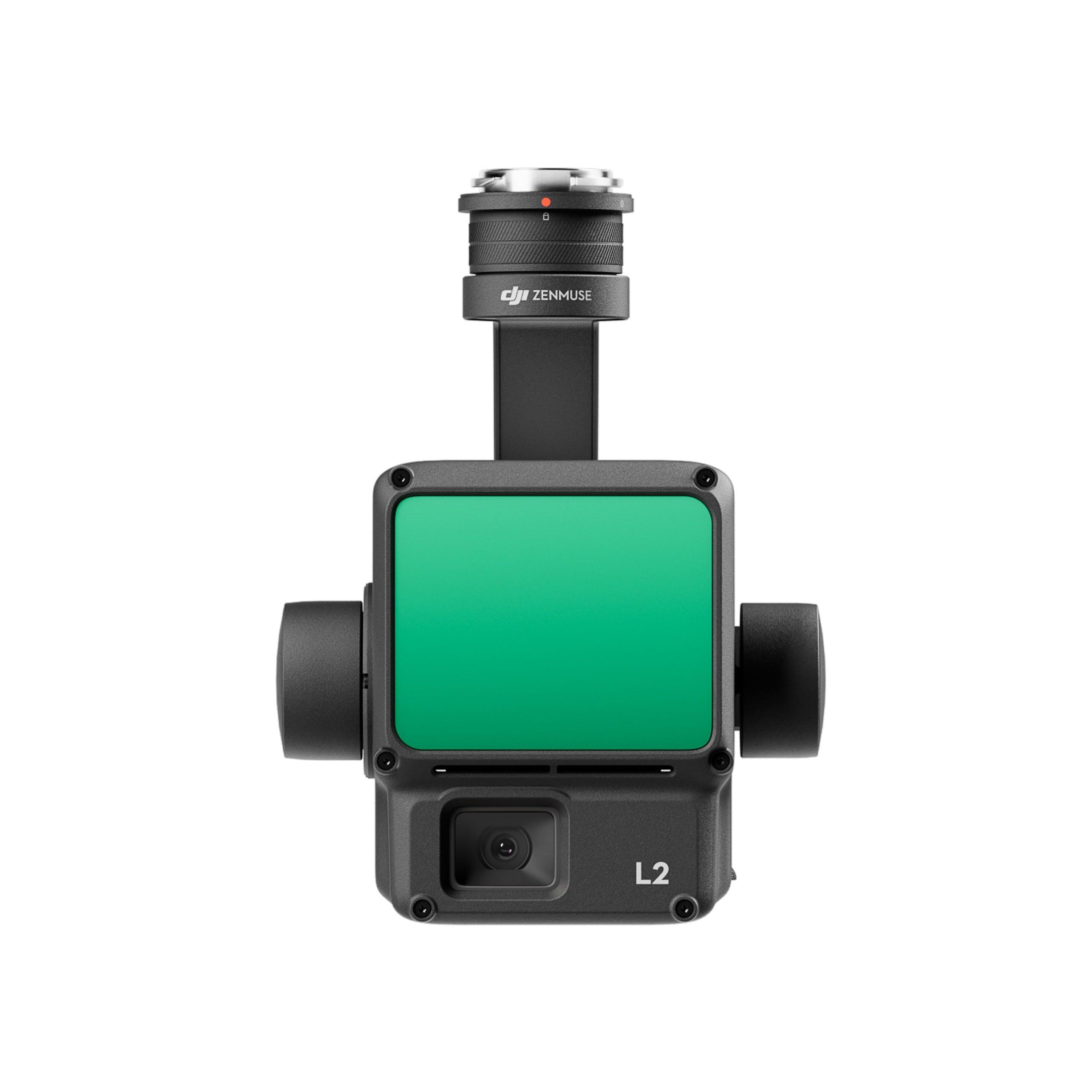
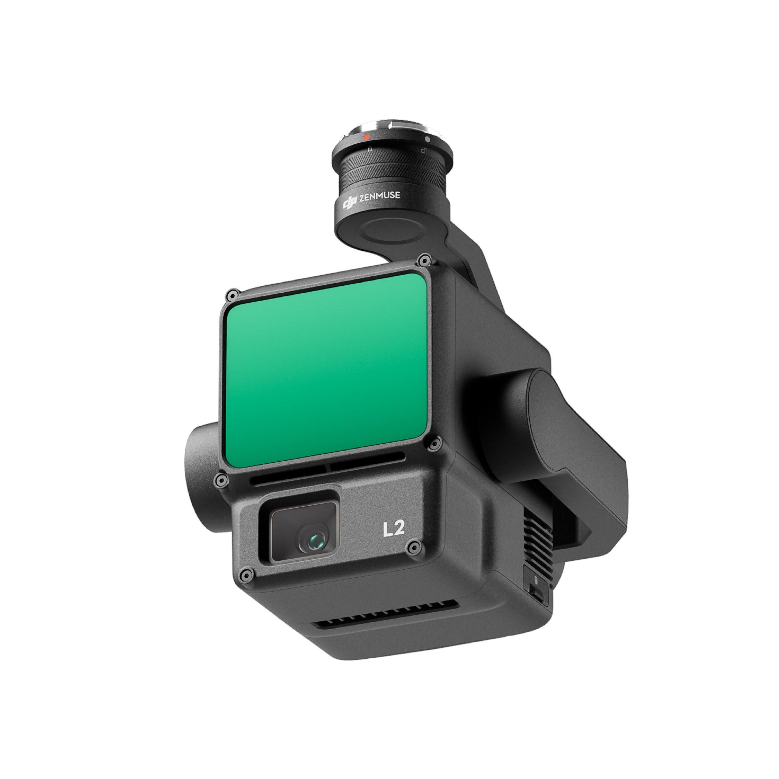
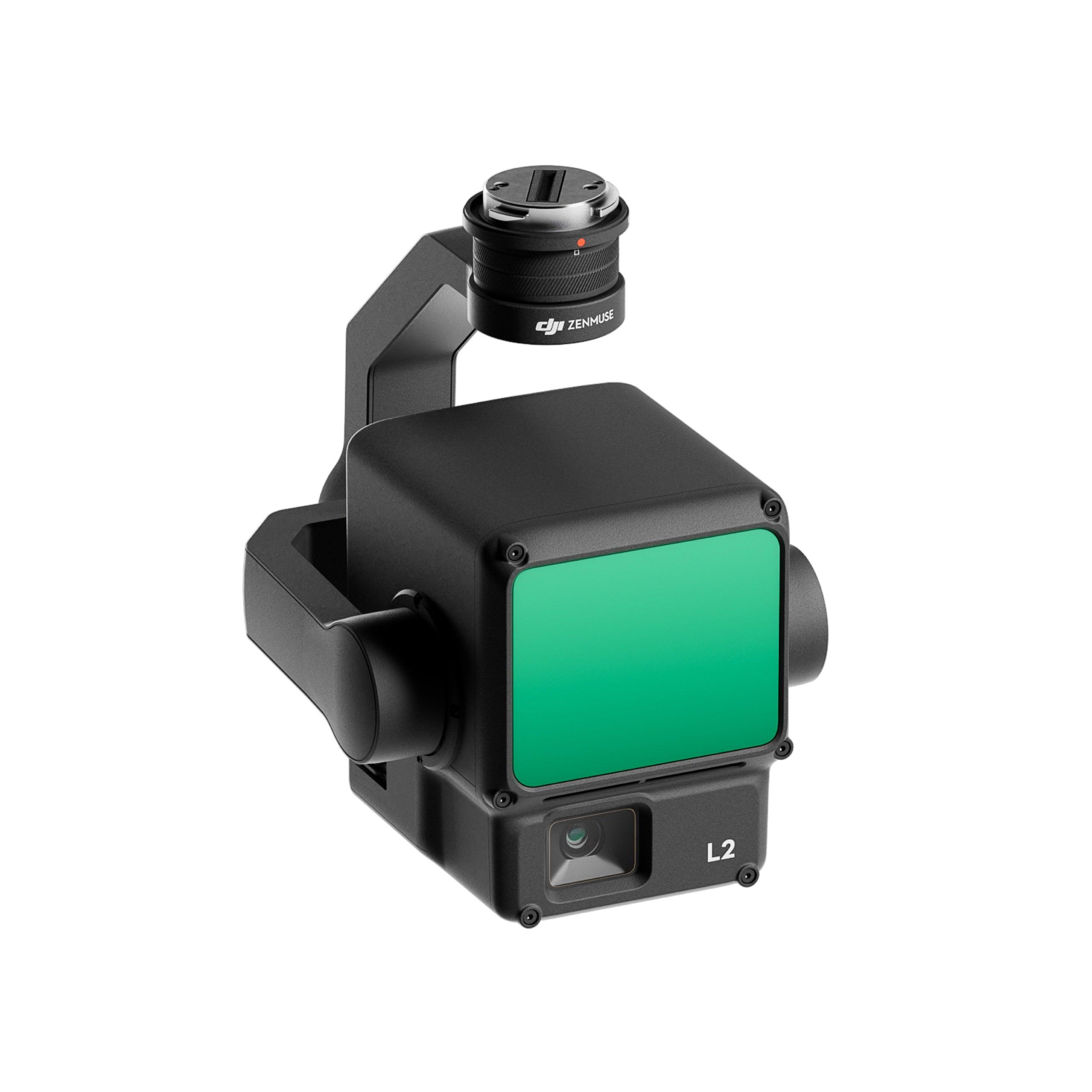
DJI Zenmuse L2
High-Precision Aerial LiDAR System
Zenmuse L2 integrates frame LiDAR, a self-developed high-accuracy IMU system, and a 4/3 CMOS RGB mapping camera, providing DJI flight platforms with more precise, efficient, and reliable geospatial data acquisition. When used with DJI Terra, it delivers a turnkey solution for 3D data collection and high-accuracy post-processing.


Integrated LiDAR Solution
Supported by its powerful hardware, L2 can allow for a precise scan of complex subjects within an extended range and faster point cloud acquisition. During operations, users can preview, playback, and process point cloud models on-site, with Task Quality Reports generated by DJI Terra, offering a simple, one-stop solution to improve overall efficiency. This enables users to achieve high-precision point cloud results with one-stop post-processing.
High-Level Precision
By combining GNSS and a high-accuracy self-developed IMU, this solution achieves 4cm vertical accuracy and 5cm horizontal accuracy.
Exceptional Efficiency
It’s ready for work as soon as it’s powered on and can collect both geospatial and RGB data from a 2.5km2 area in a single flight.
Intuitive Operation
In conjunction with Matrice 350 RTK and DJI Terra, L2 offers a turnkey solution that is simple to use, lowering the operational threshold.
Frame-Based LiDAR
30% Detection Range Increase
L2 can detect from 250 meters at 10% reflectivity and 100 klx, [3] and up to 450 meters at 50% reflectivity and 0 klx. [3] The typical operational altitude now extends up to 120 meters, notably enhancing operational safety and efficiency.
Smaller Laser Spots, Denser Point Clouds
With a reduced spot size of 4×12 cm @100m, only a fifth of that of L1, L2 not only detects smaller objects with more details, but can also penetrate denser vegetation, generating more accurate digital elevation models (DEM).
Supports 5 Returns
In densely vegetated areas, L2 can capture more ground points beneath the foliage.
Effective Point Cloud Rate: 240,000 pts/s
In both single and multiple return modes, L2 can reach a max point cloud emission rate of 240,000 points per second, allowing the acquisition of more point cloud data in a given time frame.
Two Scanning Modes
L2 supports two scanning modes, offering flexibility for users based on their task demands. In repetitive scanning mode, L2's LiDAR can achieve more uniform and accurate point clouds while meeting high-precision mapping requirements. In non-repetitive scanning mode, it offers deeper penetration for more structural information, making it suitable for power line inspection, forestry surveying, and other scenarios.
Frame-based Design
The frame-based design results in an effective point cloud data rate of up to 100%. Together with a three-axis gimbal, it brings more possibilities to surveying scenarios.
High-Accuracy IMU System
Improved Accuracy
The high-accuracy self-developed IMU system, combined with the drone’s RTK positioning system for data fusion during post-processing, gives L2 access to highly accurate absolute position, speed, and attitude information. In addition, the IMU system’s enhanced environmental adaptability improves the operational reliability and precision of L2.
No IMU Warm-up
The performance of the IMU system has been significantly enhanced, and it is ready for use the moment it's powered on. And, the accompanying drone is ready to begin tasks immediately once the RTK is in FIX status, delivering an optimized in-the-field experience.
RGB Mapping Camera
4/3 CMOS, Mechanical Shutter
Pixel size has been enlarged to 3.3 μm, and effective pixels now reach 20 MP, resulting in a significant improvement in overall imaging, as well as more enriched true-color point cloud details. The minimum photo interval has been reduced to 0.7 seconds. The mapping camera has a shutter count of up to 200,000 times, further reducing operational costs. When point cloud collection is not needed, the RGB camera can still take photos and videos, or collect images for visible light mapping.
Enhanced Operational Experience
Diverse Flight - Route Types - Point Cloud - LiveView - Point Cloud Model - Playback and Merging - Auto-Generated Task - Quality Report - PPK Solution - One Click Processing on DJI Terra
Application Scenarios
In coordination with DJI Enterprise flight platforms and DJI Terra, Zenmuse L2 can be applied to land surveying and mapping, electricity, forestry, and infrastructure management, as well as other scenarios.
FAQs
Please read our FAQs page to find out more.
What is DJI Maintenance Program?
DJI Maintenance Program is an aircraft service plan launched by DJI. The service includes basic inspection, update and calibration, deep clean, easily worn parts replacement, core components replacement, and maintenance reports.
If parts that are not covered by DJI Maintenance Program are damaged, then users need to pay to have these parts repaired.
Currently, what areas and product models are supported by DJI Maintenance Program?
Currently supported countries and regions: Currently supported countries and regions: Mainland China, North America (US and Canada), EU, UK, Australia, and Japan.
Currently supported product models: Matrice 200 V2 Serie, Mavic 2 Enterprise Serie, Phantom 4 RTK, P4 Multispectral, Matrice 300 RTK, Matrice 350 RTK, Matrice 30 Serie, Mavic 3 Enterprise Serie, Matrice 3D Serie, DJI Matrice 4 Serie, DJI Matrice 4D Serie, DJI Matrice 400, DJI Mavic 3T Advanced.
* The supported areas for some models are different.
Under which conditions can users use DJI Maintenance Program?
Users can use DJI Maintenance Program as long as:
(1) The products have not been modified or disassembled without previous authorization.
(2) The products are not water damaged.
One maintenance code can be redeemed for the maintenance service how many times?
One maintenance code can be used for the maintenance service one time.
How long is the maintenance code valid for?
The period of validity for the DJI Maintenance Program activation code is 24 months from the date of sale by DJI in North America (the United States and Canada), the European Union, the United Kingdom, Australia, and Japan.
How can I use DJI Maintenance Program?
1) When your DJI aircraft needs maintenance service, you can go to the DJI Online Repair Request page to apply for the maintenance service.
2) After applying for the maintenance service, mail your DJI aircraft to the designated repair center.
3) DJI will provide the corresponding service based on the maintenance plan you chose. If malfunctions not covered by the maintenance service are found during damage assessment, then DJI will send you a quotation for repairing these damaged parts. You can then choose whether to repair these parts or not.
How are the shipping fees and taxes charged for the DJI Maintenance Program?
The two-way shipping fees are covered by DJI if using the DJI Maintenance Program in the corresponding supported region.
If you are in an area which is not supported by the DJI Maintenance Program you purchased, shipping fees and taxes incurred due to cross-region use will be covered by yourself.
If you are in an area which is not supported by the DJI Maintenance Program you purchased but you still want to use the service, you can obtain permission from DJI first, and then shipping fees as well as taxes incurred due to cross-region use will be covered by yourself. If the above conditions are not met, DJI has the right to reject providing the service.
How to check the serial number of my drone or payload?
Please refer to How to find serial number for more information.covered by yourself. If the above conditions are not met, DJI has the right to reject providing the service.