If you have any questions, you are always welcome to contact us. We'll get back to you as soon as possible, within 24 hours on weekdays.
-
Shipping Information
Use this text to answer questions in as much detail as possible for your customers.
-
Customer Support
Use this text to answer questions in as much detail as possible for your customers.
-
FAQ’s
Use this text to answer questions in as much detail as possible for your customers.
-
Contact Us
Use this text to answer questions in as much detail as possible for your customers.

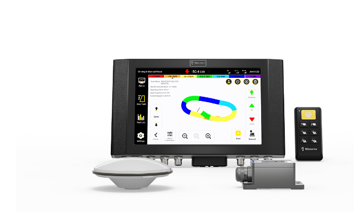
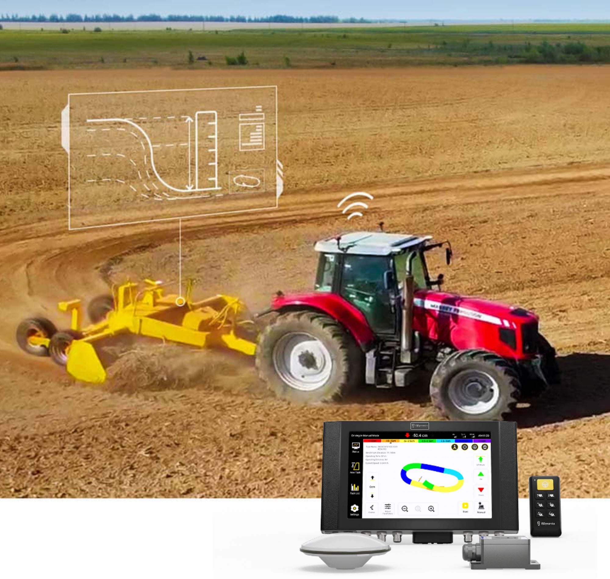
FJD AL01 3D LAND LEVELING SYSTEM
Leveling for the Next-level Yield
Streamlined Project Design

Terrain Survey

Terrain Design

Record Reserve

GNSS-based Land Leveling System